/%C3%85-(Lofoten)-(004).hero.jpg?w=1024)
Description
Å (Å i Lofoten), from å meaning “stream”, is a village in Moskenes municipality in Nordland county, Norway. It is located about 2 km southwest of the village of Sørvågen on the island of Moskenesøya, towards the southern end of the Lofoten archipelago.
It is connected to the rest of the archipelago by the European route E10 highway, which ends here. In the past, Å was mainly a small fishing village specialising in stockfish.
The village (originally a farm) is first mentioned in 1567 (“Aa”). The name is from Old Norse á which means “(small) river”. The name was spelled Aa until 1917 when the Norwegian language reform changed the letter aa to å. The village is sometimes referred to as Å i Lofoten (“i” means “in”) to distinguish it from other places named Å.
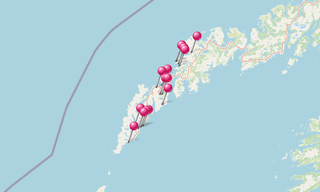
Map
.map.png)
★ Open the Google Maps link in a new window at the location: Å (Lofoten)
Photo gallery
2 Photos
Photos 1 to 2
/%C3%85-(Lofoten)-(004).jpg)
/%C3%85-(Lofoten)-(010).jpg)
★ Don’t miss: The most beautiful photos of Norway
Related topics
-(295).hero.jpg?w=320)
Beaches
330 Photos
The most beautiful beaches around the world.
.hero.jpg?w=320)
Iceland
191 Photos
Iceland is a Nordic island country of Europe located in the North Atlantic Ocean. It has a population of 332,529 and an area of 103,000 km², making it the …
-(121).hero.jpg?w=320)
Norway
131 Photos
Lofoten is an archipelago in the county of Nordland, Norway. Lofoten is known for a distinctive scenery with dramatic mountains and peaks, open sea and …