.hero.jpg?w=1024)
Description
Hverarönd, literally meaning “hot springs of the ducks”, also called by Námafjall metonymy of the name of the mountain at the foot of which it is located, is a hydrothermal site of Iceland presenting hot springs, fumaroles, mud puddles and solfataras very active. It lies in the north of the country, east of Reykjahlíð, at the foot of the Námafjall.
It is surrounded on the west by the Mývatn and the locality of Reykjahlíð on its shore, on the north by the Híðardalur and further the caldera of Krafla, on the east and south by the Búrfellshraun lava desert and immediately west by the Námafjall, a small mountain that gave it its second name. …
Show the remaining text
Groundwater heated by the magma of the magma chamber of Krafla rises from the subsoil laden with minerals and volcanic gases that liberate, condense and crystallize to the surface.
Temperatures are around 80 to 100 °C. Hydrogen sulphide released with other volcanic gases gives the site a characteristic rotten egg odor.
Map
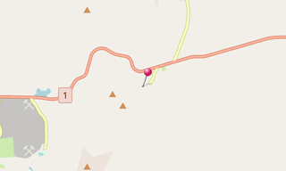
★ Open the Google Maps link in a new window at the location: Hverarönd
Photo gallery
28 Photos
Photos 1 to 28
.jpg)
.jpg)
.jpg)
.jpg)
.jpg)
.jpg)
.jpg)
.jpg)
.jpg)
.jpg)
.jpg)
.jpg)
.jpg)
.jpg)
.jpg)
.jpg)
.jpg)
.jpg)
.jpg)
.jpg)
.jpg)
.jpg)
.jpg)
.jpg)
.jpg)
.jpg)
.jpg)
.jpg)
★ Don’t miss: The most beautiful photos of Iceland
Related topics
.hero.jpg?w=320)
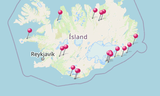
Iceland
191 Photos
Iceland is a Nordic island country of Europe located in the North Atlantic Ocean. It has a population of 332,529 and an area of 103,000 km², making it the …
-(121).hero.jpg?w=320)
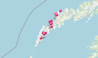
Norway
131 Photos
Lofoten is an archipelago in the county of Nordland, Norway. Lofoten is known for a distinctive scenery with dramatic mountains and peaks, open sea and …