-Inning-am-Ammersee.hero.landscape.jpg?w=1600)
-Buch-am-Ammersee.jpg)
-Inning-am-Ammersee.jpg)
-Inning-am-Ammersee.jpg)
-Inning-am-Ammersee.jpg)
-Inning-am-Ammersee.jpg)
-Inning-am-Ammersee.jpg)
-Inning-am-Ammersee.jpg)
-Inning-am-Ammersee.jpg)
-Buch-am-Ammersee.jpg)
-Herrsching-am-Ammersee.jpg)
-Breitbrunn.jpg)
-Inning-am-Ammersee.jpg)
-Herrsching-am-Ammersee.jpg)
-Inning-am-Ammersee.jpg)
-Herrsching-am-Ammersee.jpg)
-Buch-am-Ammersee.jpg)
-Inning-am-Ammersee.jpg)
-Inning-am-Ammersee.jpg)
-Inning-am-Ammersee.jpg)
-Inning-am-Ammersee.jpg)
-Inning-am-Ammersee.jpg)
-Inning-am-Ammersee.jpg)
-Inning-am-Ammersee.jpg)
-Inning-am-Ammersee.jpg)
-Inning-am-Ammersee.jpg)
-Breitbrunn.jpg)
-Inning-am-Ammersee.jpg)
-Inning-am-Ammersee.jpg)
-Buch-am-Ammersee.jpg)
-Inning-am-Ammersee.jpg)
-Inning-am-Ammersee.jpg)
-Inning-am-Ammersee.jpg)
-Buch-am-Ammersee.jpg)
-Inning-am-Ammersee.jpg)
-Herrsching-am-Ammersee.jpg)
-Inning-am-Ammersee.jpg)
-Inning-am-Ammersee.jpg)
-Inning-am-Ammersee.jpg)
-Inning-am-Ammersee.jpg)
-Herrsching-am-Ammersee.jpg)
-Herrsching-am-Ammersee.jpg)
-Herrsching-am-Ammersee.jpg)
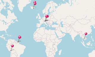
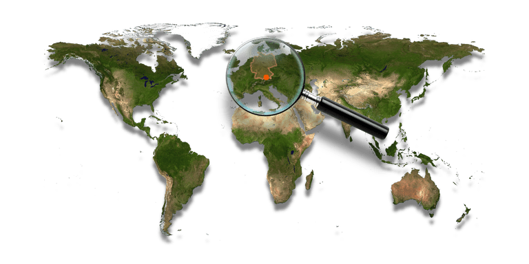
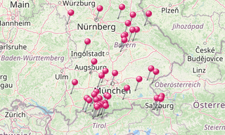
The Ammersee is after Chiemsee and Lake Starnberg the third largest lake in Bavaria (under the lakes, which lie exclusively in Bavaria) and reaching the farthest north alpine lake. The lake is owned by the Free State of Bavaria, the Bavarian Administration of State-Owned Palaces - Gardens and Lakes (Bayerische Verwaltung der staatlichen Schlösser - Gärten und Seen) is responsible for its management. The lake has an area of approximately 47 km² and a maximum depth of about 80 m. The Ammersee like other lakes of the Bavarian Alpine foothills, resulted from the melting of the ice age glaciers.
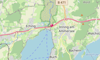
Inning am Ammersee is a municipality in the Upper Bavarian district of Starnberg and lies between the eastern shore of the Ammersee and the Wörthsee.
Buch am Ammersee is a district of the municipality Inning am Ammersee in the Upper Bavarian district of Starnberg.
Breitbrunn am Ammersee is a district of the municipality Herrsching am Ammersee in the district of Starnberg in Upper Bavaria.
Herrsching am Ammersee is about 40 km southwest of Munich in the Fünfseenland on the east bank of the Ammersee below the Andechs Monastery with the Andechs Monastery Church.
-Zugspitze.hero.jpg?w=320)
-Obersee.hero.jpg?w=320)