.hero.jpg?w=1024)
Description
Gullfoss (“Golden Falls”) is a waterfall located in the canyon of Hvítá river in southwest Iceland. The wide Hvítá river rushes southward, and about a kilometre above the falls it turns sharply to the right and flows down into a wide curved three-step “staircase” and then abruptly plunges in two stages (11 m, and 21 m) into a crevice 32 m deep.
The crevice, about 20 m wide and 2.5 km in length, extends perpendicular to the flow of the river. The average amount of water running down the waterfall is 140 m³/s in the summer and 80 m³/s in the winter. …
Show the remaining text
The highest flood measured was 2,000 m³/s.
During the first half of the 20th century and some years into the late 20th century, there was much speculation about using Gullfoss to generate electricity.
During this period, the waterfall was rented indirectly by its owners, Tómas Tómasson and Halldór Halldórsson, to foreign investors.
However, the investors’ attempts were unsuccessful, partly due to lack of money. The waterfall was later sold to the state of Iceland, and is now protected.
Map
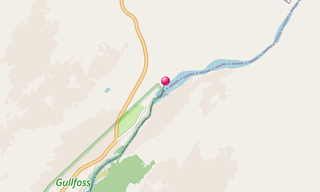
★ Open the Google Maps link in a new window at the location: Gullfoss
Photo gallery
10 Photos
Photos 1 to 10
.jpg)
.jpg)
.jpg)
.jpg)
.jpg)
.jpg)
.jpg)
.jpg)
.jpg)
.jpg)
★ Don’t miss: The most beautiful photos of Iceland
Related topics
.hero.jpg?w=320)
Iceland
191 Photos
Iceland is a Nordic island country of Europe located in the North Atlantic Ocean. It has a population of 332,529 and an area of 103,000 km², making it the …
-(121).hero.jpg?w=320)
Norway
131 Photos
Lofoten is an archipelago in the county of Nordland, Norway. Lofoten is known for a distinctive scenery with dramatic mountains and peaks, open sea and …