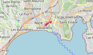
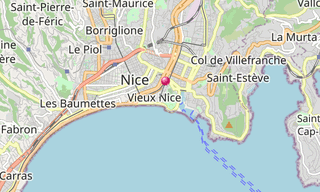
Nice is the capital of the French Riviera (Côte d’Azur) and the 5th largest city of France. Before Nice was urbanised, the coastline at Nice was just bordered by a deserted stretch of beach covered with large pebbles. The first houses were located on higher ground well away from the sea.
Starting in the second half of the 18th century, many wealthy English people took to spending the winter in Nice, enjoying the panorama along the coast. When a particularly harsh winter up north brought an influx of beggars to Nice, some of the rich Englishmen proposed a useful project for them: the construction of a walkway (chemin de promenade) along the sea. The Promenade was first called the Camin dei Anglès (the English Way) by the Niçois in their native dialect Nissart. After the annexation of Nice by France in 1860 it was rechristened La Promenade des Anglais.
Another place worth mentioning is the small street parallel to the Promenade des Anglais, leading from Nice’s downtown, beginning at Place Masséna, and running parallel to the promenade.
Main sights
Promenade of the English (Promenade des Anglais), Castel, Place Masséna, Cours Saleya, Flower Market (Marché aux Fleurs), Harbour, Botanic garden of Nice (Jardin botanique), Old Nice

-Vieux-Nice.hero.landscape.jpg)

-Vieux-Nice.jpg?w=256)
-Vieux-Nice.jpg?w=256)
-Cimetiere.jpg?w=256)
-Vieux-Nice.jpg?w=256)
-Vieux-Nice.jpg?w=256)
-Vieux-Nice.jpg?w=256)
-Marche-aux-Fleurs.jpg?w=256)
-Vieux-Nice.jpg?w=256)
-Vieux-Nice.jpg?w=256)
-Vieux-Nice.jpg?w=256)
-Cimetiere.jpg?w=256)
-Cimetiere.jpg?w=256)
-Vieux-Nice.jpg?w=256)
-Cimetiere.jpg?w=256)
.jpg?w=256)
-Vieux-Nice.jpg?w=256)
-Vieux-Nice.jpg?w=256)
-Vieux-Nice.jpg?w=256)
-Marche-aux-Fleurs.jpg?w=256)
-Vieux-Nice.jpg?w=256)
-Vieux-Nice.jpg?w=256)
-Cimetiere.jpg?w=256)
-Vieux-Nice.jpg?w=256)
-Marche-aux-Fleurs.jpg?w=256)
-Vieux-Nice.jpg?w=256)
-Vieux-Nice.jpg?w=256)
-Vieux-Nice.jpg?w=256)
-Vieux-Nice.jpg?w=256)
-Vieux-Nice.jpg?w=256)
-Vieux-Nice.jpg?w=256)
-Marche-aux-Fleurs.jpg?w=256)
-Marche-aux-Fleurs.jpg?w=256)
-Marche-aux-Fleurs.jpg?w=256)
.jpg?w=256)
-Marche-aux-Fleurs.jpg?w=256)
-Vieux-Nice.jpg?w=256)
.jpg?w=256)
-Vieux-Nice.jpg?w=256)
-Vieux-Nice.jpg?w=256)
-Vieux-Nice.jpg?w=256)
.jpg?w=256)
-Cimetiere.jpg?w=256)
-Marche-aux-Fleurs.jpg?w=256)
-Vieux-Nice.jpg?w=256)
-Cimetiere.jpg?w=256)
-Marche-aux-Fleurs.jpg?w=256)
-Vieux-Nice.jpg?w=256)
-Vieux-Nice.jpg?w=256)
-Vieux-Nice.hero.jpg?w=320)

.hero.jpg?w=320)

-Vieux-Nice.jpg?w=256)
-Marche-aux-Fleurs.jpg?w=256)
-Vieux-Nice.jpg?w=256)
-Cimetiere.jpg?w=256)
-Vieux-Nice.jpg?w=256)
-Vieux-Nice.jpg?w=256)
.jpg?w=256)
-Vieux-Nice.jpg?w=256)
-Vieux-Nice.jpg?w=256)
-Marche-aux-Fleurs.jpg?w=256)
-Vieux-Nice.jpg?w=256)
-Vieux-Nice.jpg?w=256)
-Vieux-Nice.jpg?w=256)
-Cimetiere.jpg?w=256)
-Vieux-Nice.jpg?w=256)
-Vieux-Nice.jpg?w=256)
-Vieux-Nice.jpg?w=256)
-Vieux-Nice.jpg?w=256)
-Vieux-Nice.jpg?w=256)
-Marche-aux-Fleurs.jpg?w=256)
-Vieux-Nice.jpg?w=256)
-Vieux-Nice.jpg?w=256)
-Cimetiere.jpg?w=256)
-Cimetiere.jpg?w=256)
-Vieux-Nice.jpg?w=256)
-Marche-aux-Fleurs.jpg?w=256)
-Marche-aux-Fleurs.jpg?w=256)
-Marche-aux-Fleurs.jpg?w=256)
-Vieux-Nice.jpg?w=256)
.jpg?w=256)
-Marche-aux-Fleurs.jpg?w=256)
-Marche-aux-Fleurs.jpg?w=256)
-Marche-aux-Fleurs.jpg?w=256)
-Vieux-Nice.jpg?w=256)
-Marche-aux-Fleurs.jpg?w=256)
-Vieux-Nice.jpg?w=256)
-Vieux-Nice.jpg?w=256)
-Vieux-Nice.jpg?w=256)
-Marche-aux-Fleurs.jpg?w=256)