The mill belongs since 1874 to the Schuierer family. The Schuierer mill was enlarged significantly in 1884. Since 1982, the mill is stopped.
.hero.landscape.jpg?w=1600)
The mill belongs since 1874 to the Schuierer family. [more details under description]

.jpg)
.jpg)
.jpg)
.jpg)
.jpg)
.jpg)
.jpg)
.jpg)
.jpg)
.jpg)
.jpg)
.jpg)
.jpg)
.jpg)
.jpg)
.jpg)
.jpg)
.jpg)
.jpg)
.jpg)
.jpg)
.jpg)
.jpg)
.jpg)
.jpg)
.jpg)
.jpg)
.jpg)
.jpg)
.jpg)
.jpg)
.jpg)
.jpg)
.jpg)
.jpg)
.jpg)
.jpg)
.jpg)
.jpg)
.jpg)
.jpg)
.jpg)
.jpg)
.jpg)
.jpg)
.jpg)
.jpg)
.jpg)
.jpg)
.jpg)
.jpg)
.jpg)
.jpg)
.jpg)
.jpg)
.jpg)
.jpg)
.jpg)
.jpg)
.jpg)
.jpg)
.jpg)
.jpg)
.jpg)
.jpg)
.jpg)
.jpg)
.jpg)
.jpg)
.jpg)
.jpg)
.jpg)
.jpg)
.jpg)
.jpg)
.jpg)
.jpg)
.jpg)
★ Don’t miss: The most beautiful photos of Germany
The mill belongs since 1874 to the Schuierer family. The Schuierer mill was enlarged significantly in 1884. Since 1982, the mill is stopped.
-Zugspitze.hero.jpg?w=320)
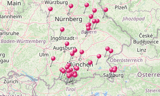
With more than 70,500 km², the Free State of Bavaria is the largest of the 16 countries in Germany and is located in the south-east. With more than 13 million …
/Maxh%C3%BCtte-(Sulzbach-Rosenberg)-(357)-Gie%C3%9Fhalle.hero.jpg?w=320)
Lost places around the world.