.hero.landscape.jpg)
-Karsha.jpg)
.jpg)
-Phuktal.jpg)
-Phuktal.jpg)
.jpg)
.jpg)
.jpg)
-Lingshed.jpg)
.jpg)
.jpg)
.jpg)
.jpg)
.jpg)
.jpg)
.jpg)
-Lingshed.jpg)
.jpg)
.jpg)
.jpg)
-Mune.jpg)
.jpg)
.jpg)
.jpg)
.jpg)
.jpg)
-Photoksar.jpg)
-Phuktal.jpg)
.jpg)
.jpg)
-Photoksar.jpg)
.jpg)
-Phuktal.jpg)
-Lingshed.jpg)
.jpg)
.jpg)
.jpg)
-Phuktal.jpg)
-Photoksar.jpg)
.jpg)
-Lingshed.jpg)
-Lamayuru.jpg)
.jpg)
.jpg)
.jpg)
.jpg)
.jpg)
.jpg)
-Karsha.jpg)
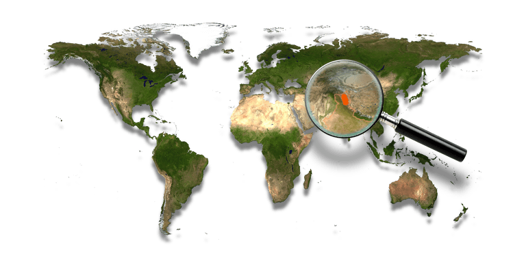
Zanskar covers an area of about 7,000 km², at an altitude between 3,500 and 7,000 m. It consists of the country lying along the two main branches of the Zanskar River; the Doda and the Lungnak rivers. The Zanskar River takes a north-eastern course until it joins the Indus in Ladakh.
High mountain ridges explain why access to Zanskar is difficult from all sides. Communication is possible across mountain passes or along the Zanskar River when frozen. Buddhism gained its influence over Zanskar in the 8th century. Until the 15th century, Zanskar was an independent Buddhist Kingdom ruled by two to four royal families.
After the 15th century, Zanskar has been subordinate to Ladakh.
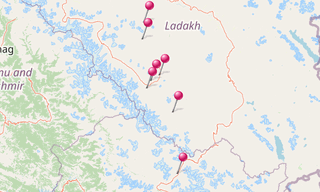
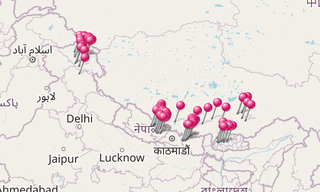
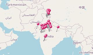
Main sights
Darcha, Karsha Gompa, Lamayuru Gompa, Lingshed Gompa, Padum, Photoksar, Phuktal Gompa, Zangla
-Tengboche-(3860m).hero.jpg?w=320)
.hero.jpg?w=320)
.hero.jpg?w=320)
-Lingshed.jpg)
-Karsha.jpg)
-Darcha.jpg)
-Karsha.jpg)
.jpg)
-Lingshed.jpg)
.jpg)
-Lingshed.jpg)
.jpg)
.jpg)
.jpg)
.jpg)
.jpg)
-Phuktal.jpg)
-Tikse.jpg)
.jpg)
.jpg)
-Karsha.jpg)
.jpg)
.jpg)
.jpg)
.jpg)
-Phuktal.jpg)
-Karsha.jpg)
-Padum.jpg)
-Lamayuru.jpg)
-Lingshed.jpg)
.jpg)
.jpg)
-Leh.jpg)
-Photoksar.jpg)
-Lingshed.jpg)
.jpg)
-Darcha.jpg)
-Hemis.jpg)
-Lingshed.jpg)
.jpg)
-Phuktal.jpg)
.jpg)
-Karsha.jpg)
-Lingshed.jpg)
-Karsha.jpg)
-Mune.jpg)
.jpg)
-Darcha.jpg)
-Phuktal.jpg)
.jpg)
-Photoksar.jpg)
.jpg)
.jpg)
.jpg)
.jpg)
.jpg)
.jpg)
.jpg)
-Mune.jpg)
.jpg)
.jpg)
-Lingshed.jpg)
-Lingshed.jpg)
.jpg)
.jpg)
.jpg)
.jpg)
.jpg)
.jpg)
-Darcha.jpg)
.jpg)
-Darcha.jpg)
-Phuktal.jpg)
.jpg)
-Lingshed.jpg)
.jpg)
-Lamayuru.jpg)
-Phuktal.jpg)
.jpg)
.jpg)
.jpg)
.jpg)
-Lamayuru.jpg)
-Karsha.jpg)
.jpg)
.jpg)
-Phuktal.jpg)
-Lingshed.jpg)
.jpg)
.jpg)
.jpg)
.jpg)
.jpg)
.jpg)
-Photoksar.jpg)
.jpg)
.jpg)
-Lingshed.jpg)
-Phuktal.jpg)
-Phuktal.jpg)
-Lamayuru.jpg)
.jpg)
.jpg)
.jpg)
.jpg)
.jpg)
-Phuktal.jpg)
.jpg)
-Lamayuru.jpg)
.jpg)
-Zangla.jpg)
.jpg)
-Leh.jpg)
.jpg)
.jpg)
.jpg)
.jpg)
-Lingshed.jpg)
-Photoksar.jpg)
-Lingshed.jpg)
-Karsha.jpg)
.jpg)
-Darcha.jpg)
.jpg)
.jpg)
.jpg)
.jpg)
.jpg)
.jpg)
-Mune.jpg)
-Leh.jpg)
.jpg)
.jpg)
-Phuktal.jpg)
.jpg)
.jpg)
-Hemis.jpg)
-Lingshed.jpg)
.jpg)