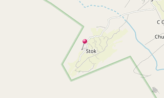
Ladakh stretches between the mountain ranges of the Himalayas (with the Stok Kangri as the most famous mountain) and the Karakorum and the upper valley of the Indus. The valleys are at an altitude of 3,000 m, making them the highest of Kashmir. The mountains reach heights of more than 7,000 m above sea level. 
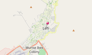
Nun, which was climbed for the first time in 1913 at 7,135 m and the neighboring Kun at 7,077 m, which was first conquered in 1906, are the highest mountains in Ladakh. The capital of Ladakh is Leh (about 27,500 inhabitants). Not far from Leh is the Khardong Pass, one of the highest passable passes in the world.
List of sights
Alchi41 photos
.jpg?w=256)
Coordinates: 34° 13′ 25″ N, 77° 10′ 31″ E
Alchi, a village and monastery situated on the bank of Indus River 70 km from the capital in Leh, is situated, unlike the other gompas in Ladakh, on lowland, not on a hilltop. The village is famous for the existence of one of the oldest monasteries… [See more]
Chemrey30 photos
.jpg?w=256)
Coordinates: 33° 57′ 29″ N, 77° 47′ 19″ E
Chemrey, gompa of the Drukpa (Red Hat) sect in eastern Ladakh, was founded in 1664 as a memorial to a local king. [See more]
Hemis65 photos
.jpg?w=256)
Coordinates: 33° 54′ 46″ N, 77° 42′ 11″ E
Hemis Gompa, a monastery 40 km south-east of Leh in Ladakh, was established in 1672 by King Senge Nampar Gyalva. [See more]
Lamayuru30 photos
.jpg?w=256)
Coordinates: 34° 16′ 58″ N, 76° 46′ 28″ E
Lamayuru Gompa, one of the largest and oldest gompas in Ladakh, housed up to 400 monks. The Indian scholar Mahasiddhacarya Naropa (956 - 1041) caused a lake which filled the valley to dry up and founded Lamayuru Monastery. [See more]
Leh79 photos
.jpg?w=256)
Coordinates: 34° 9′ 53″ N, 77° 35′ 7″ E
Leh, the capital of the Himalayan kingdom of Ladakh, is dominated by the ruined Leh Palace former home of the royal family of Ladakh, built in the same style and about the same time as the Potala Palace. Leh is at an altitude of 3,500 m. Leh has… [See more]
Matho218 photos
-Festival-of-the-Oracles.jpg?w=256)
Coordinates: 33° 59′ 56″ N, 77° 37′ 51″ E
Matho Gompa, a Tibetan Buddhist monastery in Ladakh east of Leh, is the only example of the Sakyapa sect. It is known for its annual Oracle Festival, Matho Nagran, held on the 14th and 15th days of the first month of the Tibetan calendar. During… [See more]
Phyang16 photos
.jpg?w=256)
Coordinates: 34° 11′ 12″ N, 77° 29′ 21″ E
Phyang Gompa, a Buddhist monastery located 16 km west of Leh, was established in 1515. The monastery is one of only two in Ladakh belonging to the Drigungpa School, one of eight schools derived from the teachings of Phakmadrupa Dorje Gyelpo (1110 -… [See more]
Rizong17 photos
.jpg?w=256)
Coordinates: 34° 16′ 34″ N, 77° 6′ 38″ E
Rizong Gompa, a Gelugpa or Yellow Hat Buddhist monastery, is situated at the top of a rocky side valley on the west of Alchi on the way to Lamayuru. It was established in 1831 by Lama Tsultim Nima under the Gelukpa order, at Ri-rdzong. A nunnery,… [See more]
Saspol25 photos
.jpg?w=256)
Coordinates: 34° 14′ 60″ N, 77° 9′ 38″ E
Saspol has some caves with wall-paintings as old as those at Alchi. [See more]
Spituk25 photos
.jpg?w=256)
Coordinates: 34° 7′ 32″ N, 77° 31′ 35″ E
Spituk Gompa, a Buddhist monastery located 8 km from Leh, was founded by Od-de, the elder brother of Lha Lama Changchub Od in the 11th century. [See more]
Stakna8 photos
.jpg?w=256)
Coordinates: 34° 0′ 18″ N, 77° 41′ 7″ E
Stakna Gompa, a Buddhist monastery of the Drugpa Sect, is located 25 km south-west from Leh on the right bank of the Indus River. It was founded in the late 16th century by a Bhutanese scholar and saint, Chosje Jamyang Palkar. [See more]
Stok244 photos
-Stok-Guru-Tsechu-Festival.jpg?w=256)
Coordinates: 34° 3′ 57″ N, 77° 32′ 32″ E
Stok Gompa, a Buddhist monastery 15 km south of Leh, was founded by Lama Lhawang Lotus in the 14th century. A ritual dance-mask festival is held annually. It is also the residence of the Ladakhi royalty. [See more]
Takthok26 photos
.jpg?w=256)
Coordinates: 34° 0′ 19″ N, 77° 49′ 13″ E
Takthok Gompa, a monastery in the Sakti village 46 km east of Leh in Ladakh, was founded in the mid 16th century during the reign of Tshewang Namgyal on a mountainside around a cave in which Padmasambhava is said to have meditated in the 8th… [See more]
Thiksey62 photos
.jpg?w=256)
Coordinates: 34° 3′ 23″ N, 77° 39′ 59″ E
Thiksey Gompa (Thiksay Gompa, Thikse Gompa, Tikse Gompa), a Yellow Hat (Gelugpa) Buddhist monastery, is located east of Leh at an altitude of 3,600 m. The monastery is a 12-storey complex, noted for its images and mural paintings of Buddhist art… [See more]