-Everest-(8848m)-Nuptse-(7861m).hero.landscape.jpg)
.jpg)
.jpg)
.jpg)
.jpg)
.jpg)
-Cho-Oyu-(8188m).jpg)
.jpg)
-Gokyo-(4860m).jpg)
.jpg)
.jpg)
-Gokyo-(4860m).jpg)
-Gokyo-(4860m).jpg)
.jpg)
.jpg)
.jpg)
.jpg)
-Changtse-(7543m).jpg)
.jpg)
.jpg)
.jpg)
.jpg)
-Gokyo-(4860m).jpg)
.jpg)
-Cho-Oyu-(8188m).jpg)
-Ama-Dablam-(6814m).jpg)
-Ama-Dablam-(6814m).jpg)
.jpg)
-Gokyo-(4860m).jpg)
-Pumori-(7161m).jpg)
-Everest-(8848m)-Nuptse-(7861m).jpg)
-Tengboche-(3860m).jpg)
-Gokyo-(4860m).jpg)
-Phari-Lapcha-(6017m).jpg)
.jpg)
-Everest-(8848m).jpg)
.jpg)
.jpg)
.jpg)
-Namche-Bazaar-(3440m).jpg)
.jpg)
.jpg)
.jpg)
-Tengboche-(3860m).jpg)
.jpg)
-Everest-(8848m)-Nuptse-(7861m).jpg)
.jpg)
.jpg)
-Cho-Oyu-(8188m).jpg)
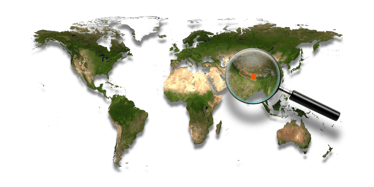
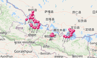
Khumbu, the Everest Region, is one of three subregions of the main Sherpa settlement of the Himalaya with elevation ranging from 3,300 m to the highest point on Earth, Mount Everest at 8,848 m. … (Khumbu 1997)
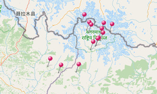
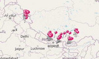
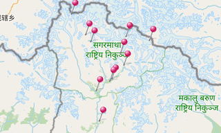
Main sights
Chele, Khumbu, Cho Oyu, Dingboche, Everest, Gokyo, Gokyo Peak, Jiri, Junbesi, Kala Pattar, Lobuche, Lhotse, Lukla, Namche Bazaar, Pangboche, Tengboche
Eight Thousanders
Everest (8,848 m), K2 (8,611 m), Kangchenjunga (8,586 m), Lhotse (8,516 m), Makalu (8,463 m), Cho Oyu (8,201 m), Dhaulagiri (8,167 m), Manaslu (8,163 m), Nanga Parbat (8,126 m), Annapurna (8,091 m), Gasherbrum I (8,068 m), Broad Peak (8,047 m), Gasherbrum II (8,035 m), Shishapangma (8,027 m)
-Tengboche-(3860m).hero.jpg?w=320)
-Changtse-(7543m).hero.jpg?w=320)
-Gyachung-Kang-(7952m).hero.jpg?w=320)
.hero.jpg?w=320)
.map.png)
.hero.jpg?w=320)
.map.png)
-Gokyo-(4860m).jpg)
.jpg)
-Everest-(8848m).jpg)
.jpg)
.jpg)
.jpg)
.jpg)
.jpg)
-Gokyo-(4860m).jpg)
.jpg)
-Gyachung-Kang-(7952m).jpg)
.jpg)
.jpg)
.jpg)
.jpg)
.jpg)
.jpg)
.jpg)
-Everest-(8848m)-Nuptse-(7861m).jpg)
.jpg)
.jpg)
.jpg)
.jpg)
.jpg)
-Namche-Bazaar-(3440m).jpg)
-Everest-(8848m).jpg)
.jpg)
.jpg)
-Everest-(8848m).jpg)
.jpg)
.jpg)
.jpg)
.jpg)
.jpg)
-Ama-Dablam-(6814m).jpg)
-Tengboche-(3860m).jpg)
.jpg)
-Gokyo-(4860m).jpg)
-Pumori-(7161m).jpg)
.jpg)
-Everest-(8848m).jpg)
.jpg)
.jpg)
.jpg)
.jpg)
.jpg)
.jpg)
.jpg)
.jpg)
.jpg)
.jpg)
.jpg)
.jpg)
-Pangboche.jpg)
.jpg)
-Gyachung-Kang-(7952m).jpg)
.jpg)
.jpg)
.jpg)
.jpg)
.jpg)
.jpg)
.jpg)