-Nieuwe-Kerk.hero.landscape.jpg)

-Stadhuis-aan-de-Markt.jpg)
.jpg)
.jpg)
.jpg)
-Nieuwe-Kerk.jpg)
-Oude-Kerk.jpg)
-Nieuwe-Kerk.jpg)
.jpg)
-Stadhuis-aan-de-Markt.jpg)
.jpg)
-Nieuwe-Kerk.jpg)
-Oude-Kerk.jpg)
.jpg)
.jpg)
-Oude-Kerk.jpg)
.jpg)
.jpg)
-Nieuwe-Kerk.jpg)
-Oude-Kerk.jpg)
-Oude-Kerk.jpg)
-Stadhuis-aan-de-Markt.jpg)
.jpg)
-Stadhuis-aan-de-Markt.jpg)
-Nieuwe-Kerk.jpg)
.jpg)
-Nieuwe-Kerk.jpg)
.jpg)
.jpg)
-Stadhuis-aan-de-Markt.jpg)
-Nieuwe-Kerk.jpg)
-Nieuwe-Kerk.jpg)
.jpg)
-Stadhuis-aan-de-Markt.jpg)
-Oude-Kerk.jpg)
-Oude-Kerk.jpg)
-Nieuwe-Kerk.jpg)
-Oude-Kerk.jpg)
-Oude-Kerk.jpg)
-Oude-Kerk.jpg)
-Oude-Kerk.jpg)
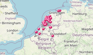
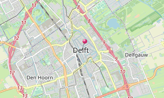
Delft, in the province of Zuid-Holland, is located in between Rotterdam and The Hague. It is primarily known for its typically Dutch town centre with canals, the painter Vermeer, the Delft Blue Pottery, the Delft University of Technology, and its association with the Dutch royal family, the House of Orange-Nassau.
The city of Delft came into being beside a canal, the “Delf”, which comes from the word delven, meaning to delve or dig, and this led to the name Delft. At the elevated place where this “Delf” crossed the creek wall of the silted up river Gantel, a Count established his manor, probably around 1075. Partly because of this, Delft became an important market town, the evidence for which can be seen in the size of its central market square.
Having been a rural village in the early Middle Ages, Delft developed into a city, and on 15 April 1246, Count Willem II granted Delft its city charter. Trade and industry flourished. In 1389 the Delfshavensche Schie canal was dug through to the river Maas, where the port of Delfshaven was built, connecting Delft to the sea.
Until the 17th century, Delft was one of the major cities of the then county (and later province) of Holland. In 1400, for example, the city had 6,500 inhabitants, making it the third largest city after Dordrecht (8,000) and Haarlem (7,000). In 1560, Amsterdam, with 28,000 inhabitants, had become the largest city, followed by Delft, Leiden and Haarlem, which each had around 14,000 inhabitants.
.hero.jpg?w=320)
.hero.jpg?w=320)