.hero.landscape.jpg)

.jpg)
.jpg)
.jpg)
.jpg)
.jpg)
.jpg)
.jpg)
.jpg)
.jpg)
.jpg)
.jpg)
.jpg)
.jpg)
.jpg)
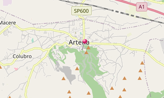
Artena is a village 30 km of Rome, situated in the north-west of Monti Lepini, in the upper valley of the Sacco River. On the mountain above the village are the fine remains of the fortifications of a city built in a very primitive style, in cyclopean blocks of local limestone. Other sights include the Palazzo Borghese (17th century), and the churches of Santa Maria delle Letizie, Santa Croce, Santo Stefano Protomartire and San Francesco.
.hero.jpg?w=320)
.hero.jpg?w=320)