.hero.landscape.jpg)
.jpg)
.jpg)
-Yamdroktso.jpg)
.jpg)
-Yamdroktso.jpg)
.jpg)
.jpg)
.jpg)
.jpg)
.jpg)
.jpg)
.jpg)
.jpg)
.jpg)
-Shishapangma-(8027m).jpg)
.jpg)
.jpg)
-Yamdroktso.jpg)
.jpg)
.jpg)
.jpg)
.jpg)
.jpg)
.jpg)
.jpg)
.jpg)
.jpg)
.jpg)
.jpg)
.jpg)
.jpg)
.jpg)
.jpg)
.jpg)
.jpg)
.jpg)
.jpg)
.jpg)
.jpg)
.jpg)
-Shishapangma-(8027m).jpg)
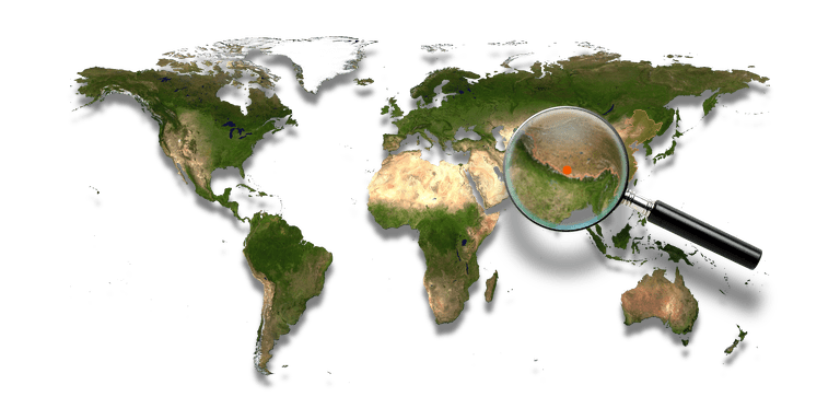
The Tibetan Plateau, also known in China as the Qinghai–Tibet Plateau or the Qingzang Plateau or Himalayan Plateau, is a vast elevated plateau in Central Asia and East Asia, covering most of the Tibet Autonomous Region and Qinghai Province in western China, as well as part of Ladakh in Jammu and Kashmir state of India.
It stretches approximately 1,000 km north to south and 2,500 k east to west. With an average elevation exceeding 4,500 m, the Tibetan Plateau is sometimes called the “Roof of the World” and is the world’s highest and largest plateau, with an area of 2,500,000 km² (about five times the size of Metropolitan France).
Sometimes termed the Third Pole, the Tibetan Plateau contains the headwaters of the drainage basins of most of the streams in surrounding regions. Its tens of thousands of glaciers and other geographical and ecological features serve as a “water tower” storing water and maintaining flow.
.hero.jpg?w=320)
.map.png)
-Lhassa-Jokhang.hero.jpg?w=320)