Raoul KiefferPhotography
Geroldsee (Wagenbrüchsee) (269)
Photo: Geroldsee (Wagenbrüchsee)

Alps
392 Photos

Description

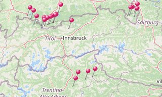
The Alps are the highest mountains in Europe. …

See more …

It stretches in a 1,200 km long and between 150 and 250 km wide arch from the Ligurian Sea to the Pannonian Basin. The summit heights in the western mountain ranges are usually between 3,000 and 4,300 m above sea level, in the Eastern Alps, the mountains are slightly lower. The highest peak in the Alps is the Mont Blanc at 4,810 m. 128 mountains of the Alps are four-thousanders, many more or less glaciated. The Alps are divided into numerous mountain groups and chains. The Alpine region covers areas of the eight Alpine states France, Monaco, Italy, Switzerland, Liechtenstein, Germany, Austria and Slovenia.

Map: Alps

List of sights
392 Photos

Barmsee (22)
Photo: Barmsee

Barmsee
3 Photos

The Barmsee is a maximum of 1.12 km long and a maximum of 0.49 km wide lake in the district of Garmisch-Partenkirchen (Upper Bavaria) in the …

Map: Barmsee
Church village of Wamberg (56)
Photo: Church village of Wamberg

Church village of Wamberg
12 Photos

The church village of Wamberg is part of the municipality of Garmisch-Partenkirchen (Upper Bavaria) at 996 m. The place is on the north side of the …

Map: Church village of Wamberg
Dolomiti (1196) Seiser Alm - Sassolungo (3.181 m)
Photo: Dolomiti, Seiser Alm - Sassolungo (3.181 m)

Dolomites
48 Photos

The Dolomites (Dolomiti), also known as the Dolomite Mountains, Dolomite Alps or Dolomitic Alps, are a mountain range located in northeastern Italy

Map: Dolomites
Eibsee (172) Zugspitze
Photo: Eibsee, Zugspitze

Eibsee
21 Photos

The Eibsee is a lake 9 km southwest of Garmisch-Partenkirchen below (3.5 km north) of the Zugspitze (2,962 m) in the Wetterstein mountains in …

Map: Eibsee
Geroldsee (Wagenbrüchsee) (322)
Photo: Geroldsee (Wagenbrüchsee)

Geroldsee (Wagenbrüchsee)
30 Photos

The Geroldsee, also called Wagenbrüchsee, is a bog lake near Krün, a few kilometers from Garmisch-Partenkirchen. It has an area of 10.6 hectares, a …

Map: Geroldsee (Wagenbrüchsee)
Großer Ahornboden (259)
Photo: Großer Ahornboden

Grosser Ahornboden
9 Photos

The Große Ahornboden lies at the head of the Rißtal valley, the Enger valley, just before the village of Eng between 1080 and 1300 m above sea …

Map: Großer Ahornboden
Hintersee (Ramsauer Ache) (127)
Photo: Hintersee (Ramsauer Ache)

Hintersee (Ramsauer Ache)
10 Photos

The Hintersee (formerly Ferchensee or Forchensee) is a 16.4 hectare lake in the municipality of Ramsau in the Berchtesgadener Land, about two …

Map: Hintersee (Ramsauer Ache)
Garmisch-Partenkirchen (245) Höllental Gorge
Photo: Garmisch-Partenkirchen, Höllental Gorge

Höllental Gorge
47 Photos

The Höllental (Hell Valley) is a valley in the Zugspitze massif of the Wetterstein mountains, between Blassenkamm and Waxensteinkamm through which …

Map: Höllental Gorge
Hopfensee (1)
Photo: Hopfensee

Hopfensee
2 Photos

The Hopfensee is a maximum 2.1 km long lake with a circumference of 6.8 km north of Füssen in the district of Ostallgäu, Bavarian Swabia, Bavaria. …

Map: Hopfensee
Kochelsee (5) Schlehdorf am Kochelsee - Herzogstand - Heimgarten
Photo: Kochelsee, Schlehdorf am Kochelsee - Herzogstand - Heimgarten

Kochelsee
15 Photos

The Kochelsee (Lake Kochel) is located 70 km south of Munich on the edge of the Bavarian Alps. It belongs to the communities Schlehdorf in the west …

Map: Kochelsee
Königssee (608) Obersee
Photo: Königssee, Obersee

Königssee
52 Photos

The Königssee is a long mountain lake in Berchtesgaden in the southeast of Bavaria and part of the municipality of Schönau am Königssee. It lies at …

Map: Königssee
Maria Gern (75)
Photo: Maria Gern

Maria Gern
12 Photos

Maria Gern is located north of Berchtesgaden in the valley and on the slopes of the creek Gerner (also called Gererbach or Anzenbach), a tributary …

Map: Maria Gern
Neuschwanstein Castle (160)
Photo: Neuschwanstein Castle

Neuschwanstein Castle
17 Photos

Neuschwanstein Castle stands above Hohenschwangau close to Füssen in southern Bavaria. The building was constructed in 1869 for the Bavarian King …

Map: Neuschwanstein Castle
Garmisch-Partenkirchen (292) Partnach Gorge in Winter
Photo: Garmisch-Partenkirchen, Partnach Gorge in Winter

Partnach Gorge
59 Photos

The Partnach Gorge (Partnachklamm) is a 702 m long and partly 80 m deep gorge incised in the limestone layers of the Wetterstein massif by the …

Map: Partnach Gorge
Plansee (Tyrol) (26)
Photo: Plansee (Tyrol)

Plansee (Tyrol)
7 Photos

The Plansee is located in the district of Reutte, Tyrol, Austria within the Ammergau Alps. With almost 3 km², it is the second largest natural lake …

Map: Plansee (Tyrol)
Ramsau (188)
Photo: Ramsau

Ramsau
14 Photos

Ramsau is a municipality in the Bavarian Alps located in the district of Berchtesgadener Land, close to the border with Austria, 35 km south of …

Map: Ramsau
Zugspitze (777)
Photo: Zugspitze

Zugspitze
34 Photos

The Zugspitze with 2,962 m is the highest peak of the Wetterstein Mountains and at the same time Germany’s highest mountain. The Zugspitze massif …

Map: Zugspitze