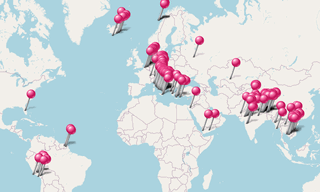
The most beautiful seaside villages around the world.
.hero.landscape.jpg)
The most beautiful seaside villages around the world. [more details under description]
.hero.jpg?w=320)
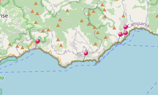
The Amalfi Coast (Costiera Amalfitana), on the south of Naples, extends from Positano in the west to Vietri sul Mare in the east.The towns lying on the …
.hero.jpg?w=320)
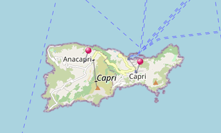
Capri is an Italian island in the Tyrrhenian Sea of the Sorrentine Peninsula. It has been a resort since the time of the Roman Republic. Features of the …
.hero.jpg?w=320)
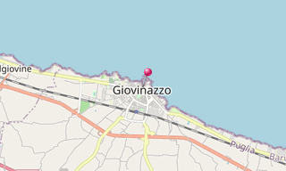
Giovinazzo, a port situated on the Adriatic Coast in the region of Apulia, lies 18 km of the provincial capital of Bari, and is adjacent to the city of …
-(208).hero.jpg?w=320)
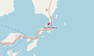
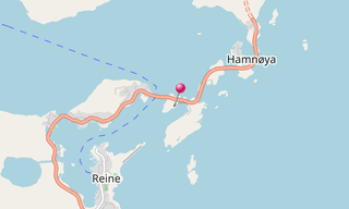
Hamnøy or Hamnøya is a small fishing village in Moskenes Municipality in Nordland county, Norway. It is located on the eastern side of the island of Moskenesøya …
.hero.jpg?w=320)
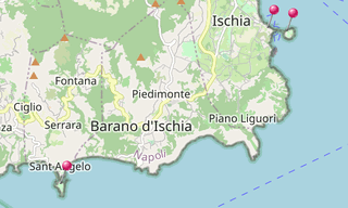
Ischia is a volcanic island in the Tyrrhenian Sea. It lies at the northern end of the Gulf of Naples, about 30 km from the city of Naples. It is the largest …
-Costa-Concordia.hero.jpg?w=320)
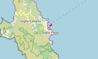
Isola del Giglio is an Italian island in the Tyrrhenian Sea (one of seven that form the Tuscan Archipelago, lying within the Arcipelago Toscano National Park …
.hero.jpg?w=320)
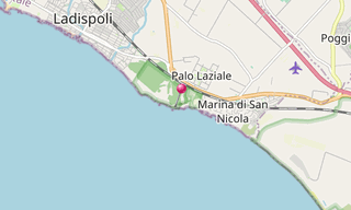
Ladispoli occupies the area of the ancient Alsium, the port of the Etruscan city of Cerveteri. It was destroyed in the 6th century, during the Gothic War …
.hero.jpg?w=320)
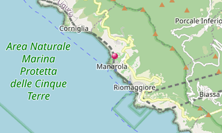
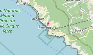
Manarola is a small village in the province of La Spezia, Liguria, northern Italy. It is the second smallest of the famous five Cinque Terre villages. …
/Marina-di-Cassano-(189).hero.jpg?w=320)
The Marina di Cassano, also known as Porto di Cassano, is located in the Italian municipality of Piano di Sorrento. The Marina di Cassano is a fishing village …
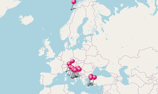
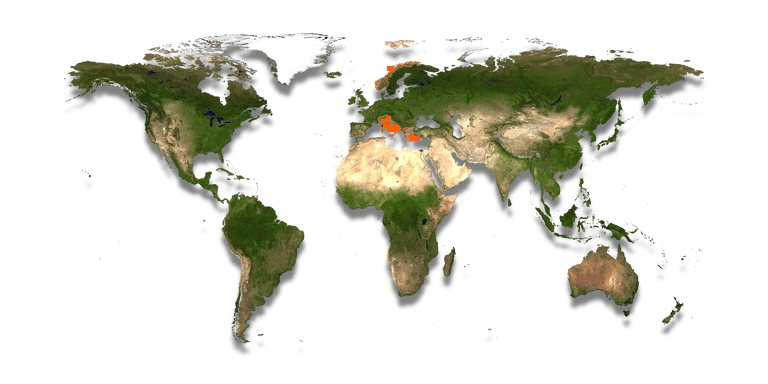
.map.png)
.hero.jpg?w=320)
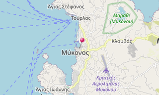
Mykonos (Μύκονος) is a Greek island, lying between Tinos, Syros, Paros and Naxos. The town is also known as Chora. Mykonos’ nickname is “The Island of the Winds …
-Chora.hero.jpg?w=320)
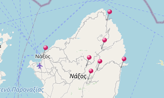
Naxos (Νάξος) is the largest island in the Cyclades island group. It was the centre of archaic Cycladic culture. The largest town and capital of the island …
-(425).hero.jpg?w=320)
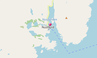
Nusfjord is a fishing village on Flakstadøy, one of the main islands of the Lofoten archipelago. The village belongs to Flakstad commune in Fylke, Norway …
-Parikia.hero.jpg?w=320)
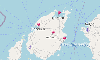
Paros (Πάρος), one of the Cyclades island group, lies to the west of Naxos, from which it is separated by a channel about 8 km wide. Historically, Paros …
.hero.jpg?w=320)
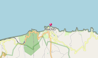
Peschici is a village in the region Puglia and is part of the Parco Nazionale del Gargano. Peschici is situated on the north-eastern coast of Gargano promontory, …
.hero.jpg?w=320)
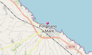
Polignano a Mare is an Italian town in the Apulia, located on the Adriatic Sea. The area was settled since prehistoric times, as shown by archaeological …
.hero.jpg?w=320)
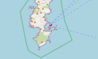
Isola Di Ponza is the largest of the Italian Pontine Islands (which are the remains of extinct volcanos), located 33 km south of Cape Circeo in the Tyrrhenian Sea …
.hero.jpg?w=320)
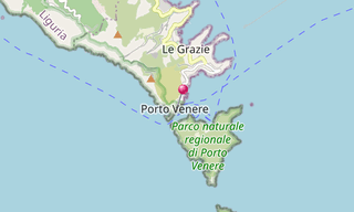
Porto Venere is a town located on the Ligurian coast of Italy in the province of La Spezia. It comprises the three villages of Fezzano, Le Grazie and Porto Venere …
.hero.jpg?w=320)
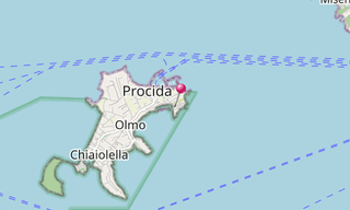
Procida is one of the Phlegrean islands off the coast of Naples in southern Italy. The island is between Cape Miseno and the island of Ischia. With its …
-(666).hero.jpg?w=320)
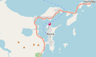
Reine is the administrative centre of Moskenes Municipality in Nordland county, Norway. The fishing village is located on the island of Moskenesøya in the …
.hero.jpg?w=320)
Riomaggiore is a village in the province of La Spezia, situated in a small valley in the Liguria region of Italy. It is the first of the Cinque Terre one …
-(034).hero.jpg?w=320)
Sakrisøy (Sakrisøya) is a small island and a fishing village between Reine and Hamnøy in the municipality of Moskenes in Lofoten. The island is located …
.hero.jpg?w=320)
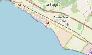
Santa Severa is part of the municipality of Santa Marinella, in the province of Rome. It is a small sea resort on the Via Aurelia, 8 km south of Santa Marinella …
-Oia.hero.jpg?w=320)
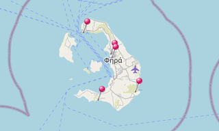
Santorini (Σαντορίνη), classically Thera, and officially Thira, is the largest island of a small, circular archipelago which bears the same name and is …
.hero.jpg?w=320)
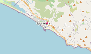
Sperlonga is a coastal town about half way between Rome and Naples. Surrounding towns include Terracina to the West, Fondi to the North, Itri to the North-East, …
-Kali-Strata.hero.jpg?w=320)
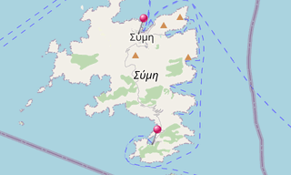
Symi (Σύμη) is a mountainous Greek island and includes the harbour town Gialos and its adjacent upper town Chora, as well as several smaller localities …
.hero.jpg?w=320)
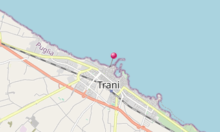
Trani is a seaport of Apulia, southern Italy, on the Adriatic Sea, in the new Province of Barletta-Andria-Trani, and 40 km West-Northwest of Bari. Trani …
.hero.jpg?w=320)
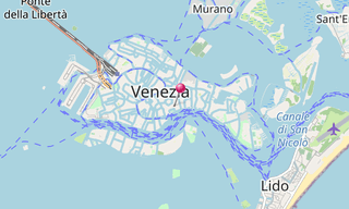
The Venetian Lagoon (Laguna di Venezia) is an enclosed bay of the Adriatic Sea, in northern Italy, in which the city of Venice is situated. Its name in …
.hero.jpg?w=320)
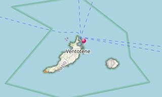
Ventotene, in Roman times known as Pandateria, is one of the Pontine Islands in the Tyrrhenian Sea, 46 km off the coast of Gaeta right at the border between …
.hero.jpg?w=320)
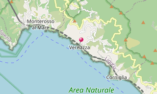
Vernazza is a town and comune located in the province of La Spezia, Liguria, northwestern Italy. It is one of the five towns that make up the Cinque Terre …
.hero.jpg?w=320)
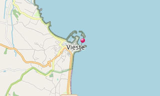
Vieste is a village in the region Puglia and is part of the Parco Nazionale del Gargano. The town is bordered by Mattinata, Monte Sant’Angelo, Peschici …
The most beautiful seaside villages around the world.
-Street-art/Schlachthof-(Munich)-(278)-Street-Art.hero.jpg?w=320)
Sight visited and photos classified by themes.