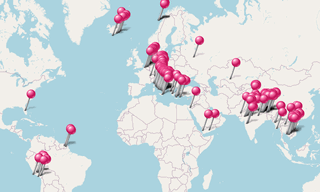
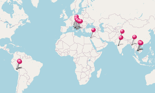
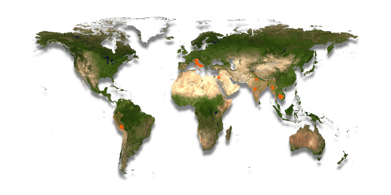
Archeological sites around the world.
.hero.landscape.jpg)
Archeological sites around the world. [more details under description]
-Cave-26.hero.jpg?w=320)
The Ajanta Caves, in Maharashtra, are 31 rock-cut cave monuments which date from the 2nd century BC. The caves include paintings and sculptures considered …
.hero.jpg?w=320)
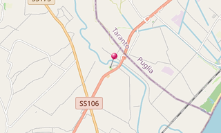
The Appian Way was one of the earliest and strategically most important Roman roads of the ancient republic. It connected Rome to Brindisi, Puglia, in south-east …
.hero.jpg?w=320)
The Aula Ottagona is part of Diocletian’s Baths and used to be called the Hall of Minerva. Probably designed originally to provide a concourse area, it …
-Pagan.hero.jpg?w=320)
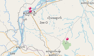
Bagan (formerly Pagan) is an ancient city located in the Mandalay Region of Myanmar. From the 9th to 13th centuries, the city was the capital of the Pagan Kingdom …
.hero.jpg?w=320)
The Baths of Caracalla in Rome, were Roman public baths, or thermae, built in Rome between AD 212 and 216, during the reign of the Emperor Caracalla. Records …
.hero.jpg?w=320)
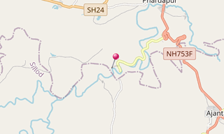
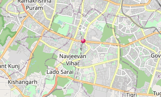
The Begumpur Mosque (Begumpur Masjid or Begumpuri Masjid) is a courtyard mosque built under the Tughluq dynasty in the 14th century in the Jahanpanah district …
.hero.jpg?w=320)
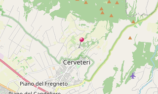
The Necropolis della Banditaccia in Cerveteri, which has been declared by UNESCO World Heritage Site together with the necropolis in Tarquinia covers an …
-Cave-16-(Kailasa-Temple).hero.jpg?w=320)
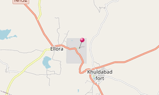
Ellora is an archaeological site, 30 km from the city of Aurangabad in the Indian state of Maharashtra built by the Rashtrakuta rulers. Well-known for its …
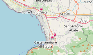
.hero.jpg?w=320)
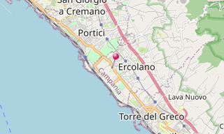
Ercolano (Herculaneum) is an ancient Roman town, located in the province of Naples which has been destroyed, along with Pompeii, in the eruption of Mount Vesuvius …
.hero.jpg?w=320)
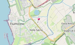
The Isola Sacra Necropolis was the first large-scale pagan cemetery of Roman Imperial times to be excavated. The excavator-in-chief of most of Isola Sacra …
.hero.jpg?w=320)
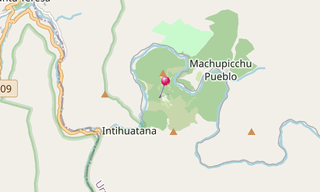
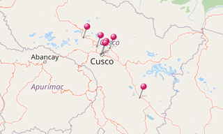
Machu Picchu is a pre-Columbian Inca site located 2,430 m above sea level and situated on a mountain ridge above the Urubamba Valley in Peru, 80 km north-west …
.hero.jpg?w=320)
Metaponto is a small town of about 1,000 people in the province of Matera, Basilicata. Metapontum was a Greek city founded by an Achaean Colony. Pythagoras …
.hero.jpg?w=320)
Norchia is an ancient Etruscan city with an adjacent necropolis which reached its high point between the 4th and 2nd centuries BC. The tombs are generally …
.hero.jpg?w=320)
As main port of the antic Rome, Ostia (Ostia Antica) was a busy trading centre over 6 centuries until the 5th century.The main street, the Decumanus Maximus …

-Inca-Ruins.hero.jpg?w=320)
The Incas built a main access route along the Urubamba Valley, connecting the site of Machu Picchu in the west and to Pisac in the east.Chinchero was the …
.hero.jpg?w=320)
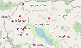
Other sites in Cambodia:The massive temple of Banteay Chhmar, along with its satellite shrines and reservoir (baray), comprises one of the most important …
.hero.jpg?w=320)
Paestum, situated close to the tyrrhenian coast on the road linking Agropoli to Battipaglia, was founded around the end of the 7th century BC by colonists …
.hero.jpg?w=320)
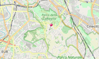
The Parco degli Acquedotti is a public park in Rome, named after the aqueducts, crossed by the Aqua Felix and containing part of the Aqua Claudia and the …
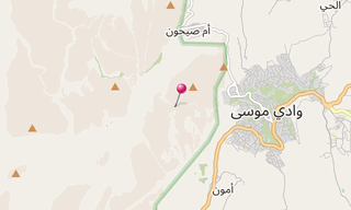
-Al-Deir.hero.jpg?w=320)
Petra, originally known to the Nabataeans as Raqmu, is a historical and archaeological city in southern Jordan. The city is famous for its rock-cut architecture …
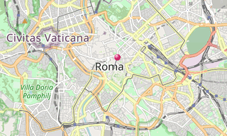
.hero.jpg?w=320)
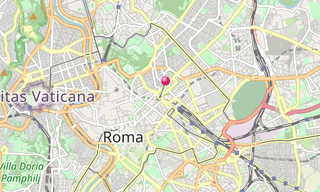
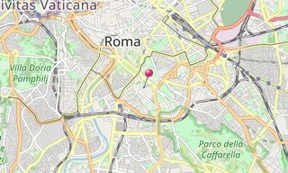
The Roman Forum (Forum Romanum, Foro Romano) is a rectangular forum (plaza) surrounded by the ruins of several important ancient government buildings at …
.hero.jpg?w=320)
Oplontis was a town near Pompeii, in the Roman Empire. On August 24 AD 79, the eruption of Mount Vesuvius buried it under large levels of ash.Oplontis, …
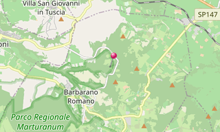
.hero.jpg?w=320)
San Guiliano is an Etruscan centre 2 km north-east of Barbarano Romano. The most important tombs found in the necropolis of Cuccumella del Caiolo are the …
.hero.jpg?w=320)
Siem Reap is the capital city of Siem Reap Province in northwestern Cambodia. Angkor was the capital city of the Khmer Empire, which flourished from approximately …
.hero.jpg?w=320)
Sutri (ancient Sutrium) occupied an important position on road into Etruria, the later Via Cassia. It came into the hands of Rome after the fall of Veii …
.hero.jpg?w=320)
Tarquinia was the chief of the twelve cities of Etruria, and appears in the earliest history of Rome as the home of two of its kings, Tarquinius Priscus …
.hero.jpg?w=320)
The Theatre of Marcellus is an ancient open-air theatre in Rome, built in the closing years of the Roman Republic. At the theatre, locals and visitors alike …
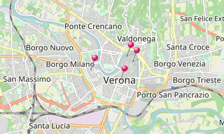
-Basilica-di-San-Zeno.hero.jpg?w=320)
Verona is a city in Veneto, northern Italy. The city has been awarded World Heritage Site status by UNESCO because of its urban structure and architecture. …
.hero.jpg?w=320)
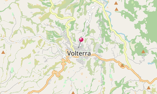
Volterra, known to the ancient Etruscans as Velathri, to the Romans as Volaterrae, is a town and municipality in the Tuscany region of Italy.
Archeological sites around the world.
-Street-art/Schlachthof-(Munich)-(278)-Street-Art.hero.jpg?w=320)
Sight visited and photos classified by themes.