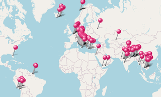
Most fascinating Castels and Palaces around the world.
.hero.landscape.jpg)
Most fascinating Castels and Palaces around the world. [more details under description]
.hero.jpg?w=320)
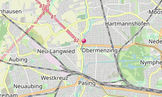
The former hunting Castle Blutenburg is located in the west of Munich, in the town district of Obermenzing. The castle dates back to a water castle of the …
-Taragarh-Fort.hero.jpg?w=320)
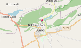
Bundi, is a city in the Hadoti region of Rajasthan state in north-west India. It is of particular architectural note for its ornate forts, palaces, and …
.hero.jpg?w=320)
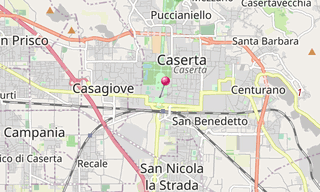
Caserta is located north east of Naples on the edge of the Campanian Plain at the foot of the Subapennine mountain range.
.hero.jpg?w=320)
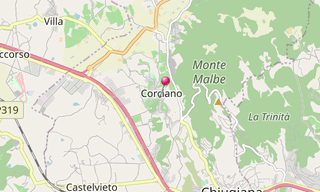
Corciano is town in the Italian region Umbria, located about 8 km west of Perugia. The earliest traces of human presence (some fragments of flint tools …
-Bir-Singh-Deo-Palace.hero.jpg?w=320)
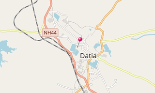
Datia, a small rural town in the state of Madhya Pradesh, was formerly the seat of the eponymous princely state in the British Raj. Datia is situated near …
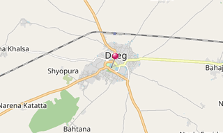
-Deeg-Palace.hero.jpg?w=320)
Deeg Palace, built in 1772, is situated near Bharatpur in Rajasthan. Deeg was the first capital of the newly carved out Jat State of Bharatpur, when Badan Singh …
.hero.jpg?w=320)
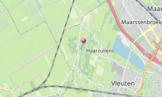
The De Haar Castle (Kasteel de Haar) in Haarzuilens was built from 1892 till 1912 largely incorporating the 15th century ruins of the original castle. Founded …
.hero.jpg?w=320)
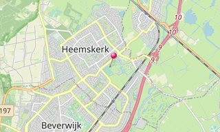
The Castel Assumburg (Kasteel Assumburg, Slot Assumburg), located on the eastside of Heemskerk, was built from the remains of Castel Oud Haerlem in 1546. …
.hero.jpg?w=320)
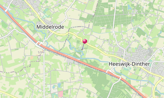
The Castle Heeswijk (Kasteel Heeswijk) is a water citadel between s-Hertogenbosch and Eindhoven. It dates back to year 1080 and was gradually replaced by …
.hero.jpg?w=320)
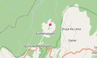
Kumbhalgarh (literally “Kumbhal fort”) is a Mewar fortress on the westerly range of Aravalli Hills, in the Rajsamand district near Udaipur of Rajasthan …
.hero.jpg?w=320)
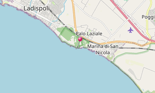
Ladispoli occupies the area of the ancient Alsium, the port of the Etruscan city of Cerveteri. It was destroyed in the 6th century, during the Gothic War …
.hero.jpg?w=320)
The Linderhof Palace (Schloss Linderhof) is the smallest of the three palaces built by King Ludwig II of Bavaria and the only one which he lived to see …
.hero.jpg?w=320)
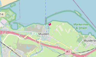
The Muiderslot is a castle in the Netherlands, located at the mouth of the Vecht River, some 15 km south-east of Amsterdam, in Muiden, where it flows into …
.hero.jpg?w=320)
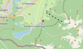
Neuschwanstein Castle stands above Hohenschwangau close to Füssen in southern Bavaria. The building was constructed in 1869 for the Bavarian King Ludwig II …
-Palace.hero.jpg?w=320)
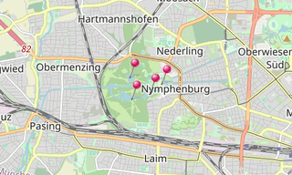
The Nymphenburg Palace (Schloss Nymphenburg) is a Baroque palace in Munich. The palace was the main summer residence of the rulers of Bavaria. The palace …
-Jahangir-Mahal.hero.jpg?w=320)
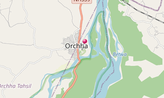
Orchha, a town 15 km from Jhansi in Uttar Pradesh, lies on the Betwa River and was the seat of an eponymous former princely state of central India, in the …
/Residenz-(Munich)-(031)-Antiquarium.hero.jpg?w=320)
The Munich Residence (Münchner Residenz) is the former royal palace of the Bavarian monarchs of the House of Wittelsbach in the centre of the city of Munich …
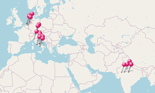
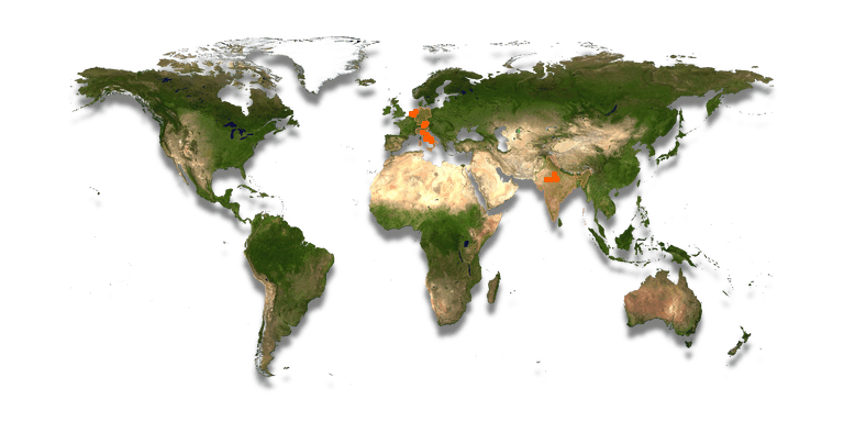
.map.png)
.hero.jpg?w=320)
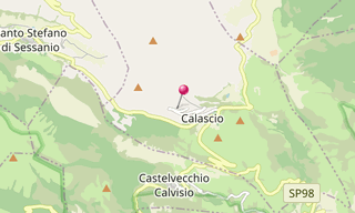
Rocca di Calascio, at an elevation of 1,460 m, is the highest fortress in Italy located in the province of L’Aquila. It was exclusively built for military …
.hero.jpg?w=320)
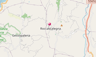
Roccascalegna is a village in the Abruzzo, 455 m above sea level on a rocky hills dominating the Rio Secco valley, an affluent on the right bank of the …
.hero.jpg?w=320)
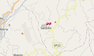
San Leo, a village in the region Emilia-Romagna, located about 135 km south-east of Bologna and about 35 km south of Rimini, is home to a large fortress …
.hero.jpg?w=320)
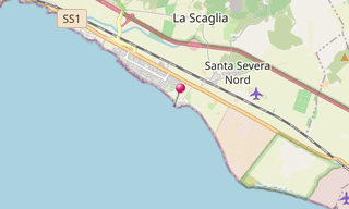
Santa Severa is part of the municipality of Santa Marinella, in the province of Rome. It is a small sea resort on the Via Aurelia, 8 km south of Santa Marinella …
.hero.jpg?w=320)
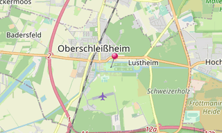
The Schleißheim Palace actually comprises three palaces in a grand baroque park in the village of Oberschleißheim near Munich. The palace was a summer residence …
-Fraeylemaborg.hero.jpg?w=320)
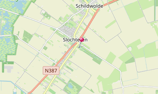
Slochteren is a municipality in the north-eastern Netherlands, characterised as a chain of small villages dividing a mostly agricultural landscape. Having …
.hero.jpg?w=320)
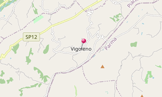
Vigoleno’s origins are rooted in the Roman era: the name comes from the Latin Vicus Lyaeo, a place consecrated to Bacchus because of its exquisite wines. …
.hero.jpg?w=320)
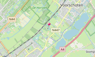
The Kasteel Duivenvoorde in the town of Voorschoten close to Vassenaar, is one of the oldest castle in Zuid-Holland. It was first mentioned in 1226. The …
Most fascinating Castels and Palaces around the world.
-Street-art/Schlachthof-(Munich)-(278)-Street-Art.hero.jpg?w=320)
Sight visited and photos classified by themes.