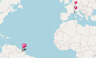
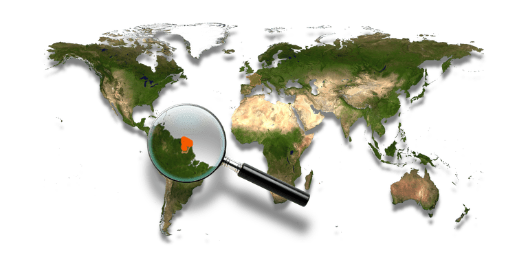
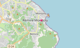
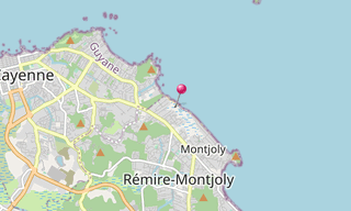
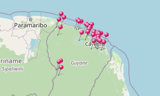
French Guiana is an overseas department and region of France on the north Atlantic coast of South America. It borders Brazil to the east and south, and Suriname to the west. Its 83,534 km² area has a very low population density of less than 3 inhabitants per km², with half of its 239,450 people in 2012 living in the metropolitan area of Cayenne, its capital. By land area, it is by far the largest overseas region of France. A large part of the department’s economy derives from the presence of the Guiana Space Centre (Centre Spatial Guyanais), now the European Space Agency’s primary launch site near the equator.
List of sights
Acarouany91 photos[See more]
.jpg?w=256)
Coordinates: 5° 35′ 26″ N, 53° 48′ 48″ W
Acarouany: In the 18th century, leprosy, imported by European settlers and slaves, affects the territory of French Guiana. The first leper colonies are installed on the Ilet La Mère off the coast of Ré (in 1774), and on the Iles du Salut off the… [See more]
Annamite Prison46 photos[See more]
.jpg?w=256)
Coordinates: 4° 49′ 45″ N, 52° 31′ 2″ W
The Bagne des Annamites was established in June 1930 and consisted of seven wood buildings with the house of the camp leaders, dungeons and a dining hall. The purpose of this camp was to develop the region of the Inini, at that time completely… [See more]
Awala-Yalimapo17 photos[See more]
.jpg?w=256)
Coordinates: 5° 44′ 46″ N, 53° 56′ 2″ W
Awala-Yalimapo is a commune on the north coast of French Guiana, close to the border with Suriname. Awala and Yalimapo are French Guiana’s northern-most settlements, located just to the south of the region’s northern-most point, the beach of Plage… [See more]
Cacao83 photos[See more]
-Marche-de-Cacao.jpg?w=256)
Coordinates: 4° 33′ 4″ N, 52° 29′ 37″ W
Cacao is a town in French Guiana, lying on the Comte River to the south of Cayenne. Most of the town’s population are Hmong farmers, refugees from Laos, who were resettled in French Guiana in the 1970s. There is a Sunday morning market at which … [See more]
Camp Caiman34 photos[See more]
.jpg?w=256)
Coordinates: 4° 34′ 6″ N, 52° 13′ 3″ W
Located 40 km from Roura, near the Camp Caiman, this cave where hundreds of bats are living, sinks into the ground. Tree roots will pick water through cracks in the ground. [See more]
Cayenne43 photos[See more]
.jpg?w=256)
Coordinates: 4° 56′ 5″ N, 52° 20′ 5″ W
Cayenne is the capital of French Guiana, an overseas region and department of France located in South America. The city is located on the banks of the estuary of the Cayenne River on the Atlantic Ocean and occupies part of the Ile de Cayenne. It is… [See more]
Dam Petit Saut91 photos[See more]
.jpg?w=256)
Coordinates: 4° 55′ 34″ N, 53° 1′ 39″ W
The dam of Petit-Saut is a dam located in the department of French Guiana between the towns of Sinnamary and Saint-Élie. Its dam lake, with an area of about 365 km² (about 16 km along on 19 km wide), is the largest in France; larger than the city… [See more]
Diamond Fortification11 photos[See more]
.jpg?w=256)
Coordinates: 4° 52′ 13″ N, 52° 14′ 51″ W
The Fort Diamant is a castle near Rémire-Montjoly in French Guiana whose construction began in 1840 and ended in 1849. It is a building of 150 m² built on a plot of 3,600 m². Fort Diamant is composed of three pieces of artillery including a recess… [See more]
Engraved Rocks of Carapa75 photos[See more]
.jpg?w=256)
Coordinates: 5° 9′ 30″ N, 52° 39′ 52″ W
The Engraved Rocks of Carapa (Roches Gravées de la Carapa), rediscovered in 1992, is the largest set of rock carvings discovered in French Guiana. The site, a historical monument since the 18th of November 1993, brings together polishers and rock… [See more]
Engraved Rocks of Mahury22 photos[See more]
.jpg?w=256)
Coordinates: 4° 51′ 26″ N, 52° 16′ 9″ W
The seven Engraved Rocks of Mahury (Roches Gravées de Mahury) form a historic monument in French Guiana, registered as such by decree of the 8th of March 2002. The seven rocks are located in the municipality of Rémire-Montjoly and are part of a set… [See more]
Favard Mountain25 photos[See more]
.jpg?w=256)
Coordinates: 4° 30′ 44″ N, 52° 2′ 44″ W
The Engraved Rocks of the Favard Mountain (Montagne Favard) is an historical monument in French Guiana. The site is registered as an historic monument by decree of the 16th of September 1991. [See more]
Fourgassier Falls11 photos[See more]
.jpg?w=256)
Coordinates: 4° 37′ 56″ N, 52° 18′ 15″ W
The Fourgassier Falls (Chutes de Fourgassier) are located a few kilometres from Roura in direction of the Marais de Kaw. [See more]
French Guiana Zoo57 photos[See more]
-Jaguar.jpg?w=256)
Coordinates: 4° 56′ 45″ N, 52° 29′ 31″ W
The 160 acre of the French Guiana Zoo (Zoo de Guyane) in Macouria is home to over 70 native animal species, giving visitors the opportunity to admire the country’s flora and fauna without having to head into the Amazon Jungle. Some 450 animals live… [See more]
Gabriel Creek28 photos[See more]
.jpg?w=256)
Coordinates: 4° 44′ 8″ N, 52° 18′ 19″ W
The Gabriel Creek (Crique Gabriel) is often presented as the most beautiful creeks of French Guiana, but it is overall the nearest one to Cayenne (about 35 km east of Cayenne). This small creek runs into the Mahury, a few hundred meters from the… [See more]
Guiana Space Centre207 photos[See more]
.jpg?w=256)
Coordinates: 5° 17′ 37″ N, 52° 49′ 38″ W
The Guiana Space Centre or, more commonly, Centre Spatial Guyanais (CSG) is a French spaceport near Kourou in French Guiana. Operational since 1968, it is particularly suitable as a location for a spaceport due to its proximity to the equator, and… [See more]
Iracoubo19 photos[See more]
.jpg?w=256)
Coordinates: 5° 28′ 45″ N, 53° 12′ 24″ W
Iracoubo is a commune on the coast of French Guiana, an overseas region and department of France located in South America. The settlement of Iracoubo, seat of the commune, is located between the settlement of Sinnamary and the hamlet of Organabo.… [See more]
Island of the Grand Constable36 photos[See more]
.jpg?w=256)
Coordinates: 4° 49′ 30″ N, 51° 56′ 11″ W
The Island of the Grand Constable (Île du Grand Connétable) is located 18 km off the mouth of the Approuague in French Guiana. With the Island of Small Constable, it forms the national nature reserve of the Grand Constable Island, managed by the … [See more]
Islet la Mère86 photos[See more]
-Saimiri.jpg?w=256)
Coordinates: 4° 53′ 22″ N, 52° 11′ 7″ W
The Islets of Rémire are a small archipelago of four islands off the town of Rémire-Montjoly (La Mère, Le Père, Le Malingre, Les Mamelles (two islets)). The Islet of the Enfant Perdu, which is a little further upstream, is generally added to them.… [See more]
Kaw-Roura Marshland82 photos[See more]
.jpg?w=256)
Coordinates: 4° 30′ 51″ N, 52° 3′ 44″ W
The Kaw-Roura Marshland Nature Reserve (Kaw Marshland or Marais de Kaw) is one of six natural reserves created by the French government in French Guiana. This reserve is the second largest nature reserve in France by area (94,700 hectares) after… [See more]
Kourou36 photos[See more]
-Market.jpg?w=256)
Coordinates: 5° 9′ 52″ N, 52° 38′ 34″ W
Kourou is located 60 km north-west of the capital Cayenne at the mouth of the Kourou River on the Atlantic coast. In 1965 the Centre Spatial Guyanais (Guiana Space Centre) was founded behind the town. [See more]
Kourou River64 photos[See more]
.jpg?w=256)
Coordinates: 4° 57′ 47″ N, 52° 45′ 32″ W
The Kourou is a river in French Guiana with a length of 112 km. The city of Kourou is at its mouth to the Atlantic Ocean. Its estuary is home to the marina. As everywhere in the Amazon, the colour of the water is brown because of the sediment… [See more]
La Mirande Trail44 photos[See more]
.jpg?w=256)
Coordinates: 4° 51′ 47″ N, 52° 20′ 41″ W
The La Mirande Trail (Sentier de la Mirande) winds through the Mount Grand-Matoury, a nature reserve mainly populated by birds. The wildlife encounters are frequent, but it is at sunrise and sunset that the chances to observe macaws, toucans and … [See more]
Loyola Trail24 photos[See more]
.jpg?w=256)
Coordinates: 4° 53′ 57″ N, 52° 16′ 13″ W
On the Loyola Trail (Sentier de Loyola) are the vestiges of an immense colonial exploitation run by Jesuits. [See more]
Maripasoula101 photos[See more]
.jpg?w=256)
Coordinates: 3° 24′ 6″ N, 53° 55′ 29″ W
Maripasoula is a French commune in the department of French Guiana. The town, the largest in France, and one of the least densely populated, is the border with Suriname and Brazil. The city is mainly populated by people from the Boni ethnicity.… [See more]
Monkey Mountain111 photos[See more]
-Hyla-boans.jpg?w=256)
Coordinates: 5° 4′ 23″ N, 52° 41′ 58″ W
The Montagne des Singes (Monkey Mountain) is located south-west of the city of Kourou, 15 km towards the Dégrad Saramaca. It rises to 161 m and some tributaries of the River Kourou left bank have their source there. [See more]
Montsinéry - Tonnegrande28 photos[See more]
.jpg?w=256)
Coordinates: 4° 57′ 58″ N, 52° 27′ 54″ W
Montsinéry-Tonnegrande, formerly Viriot, is a commune of French Guiana. It is surrounded by rivers and mangroves. [See more]
Most beautiful photos of America205 photos[See more]
.jpg?w=256)
Gallery of my best digial photos of all over Americas (French Guiana, Peru and Suriname). [See more]
Most beautiful photos of France109 photos[See more]
.jpg?w=256)
Gallery of my best photos of all over France. [See more]
Paul Isnard Track34 photos[See more]
.jpg?w=256)
Coordinates: 5° 9′ 47″ N, 53° 57′ 38″ W
The Piste Paul Isnard is a road in French Guiana. It is named after an old gold miner. At the end of the road, two sites were exploited: Citron and Paul Isnard. The former name of the company was CMPI until 1987. During the penitentiary era many… [See more]
Pripri de Yiyi82 photos[See more]
.jpg?w=256)
Coordinates: 5° 25′ 22″ N, 53° 3′ 1″ W
The great Pripri de Yiyi is located on the municipalities of Sinnamary and Iracoubo, and covers about 15,000 ha. This ecosystem occupies a central position between two other large Guyanese marshes, Kaw-Roura Marshland at the east and Savane Sarcelle… [See more]
Rorota Trail45 photos[See more]
.jpg?w=256)
Coordinates: 4° 53′ 6″ N, 52° 15′ 47″ W
With a length of 5 km, the Rorota Trail (Sentier du Rorota) connects the lakes of Rorota, of Lalouette and of Rémire in the municipality of Rémire-Montjoly and is located on the northern edge of the Plateau of Mahury. This massive rises to 170 m… [See more]
Saint Jean du Maroni20 photos[See more]
-Crique-Serpent.jpg?w=256)
Coordinates: 5° 20′ 53″ N, 54° 9′ 0″ W
Saint-Jean-du-Maroni is a town in French Guiana, in the commune of Saint-Laurent-du-Maroni on the Maroni River, directly opposite the Suriname Village of Bigiston. [See more]
Saint Laurent du Maroni8 photos[See more]
-Camp-de-la-Transportation.jpg?w=256)
Coordinates: 5° 30′ 13″ N, 54° 1′ 55″ W
Saint-Laurent-du-Maroni, called simply Saint-Laurent, is a French commune located in the department of French Guiana. In 2010, it was the second most populous municipality in French Guiana after Cayenne. [See more]
Salines de Montjoly68 photos[See more]
.jpg?w=256)
Coordinates: 4° 55′ 38″ N, 52° 16′ 41″ W
The Salines de Montjoly along Montjoly beach, cross the coastal marshes and dune vegetation, and lead to the observatory of the Kwata association where it is possible to contemplate many birds and sometimes caimans. The path continues and goes into… [See more]
Salvation Islands174 photos[See more]
-Ile-Saint-Joseph.jpg?w=256)
Coordinates: 5° 17′ 15″ N, 52° 35′ 20″ W
The Iles du Salut are a group of small islands of volcanic origin about 11 km from the coast of French Guiana (14 km north of Kourou) in the Atlantic Ocean. The Ile du Diable is better known to English speakers as Devil’s Island. The total area is… [See more]
Trésor Trail50 photos[See more]
.jpg?w=256)
Coordinates: 4° 34′ 44″ N, 52° 14′ 36″ W
The Tresor Trail (Sentier Trésor) is named after the Trésor mine, which was used for many years for its deposits of gold, then abandoned. The few remnants of this operation are outside of the reserve. Being a voluntary nature reserve, managers are… [See more]
Trou Poissons - Cemetery of the Fathers20 photos[See more]
.jpg?w=256)
Coordinates: 5° 25′ 19″ N, 53° 8′ 2″ W
Between 1797 and 1799 more than a thousand priests were sentenced to transportation in French Guiana, because they refused to take the oath to the Civil Constitution of the Clergy (Constitution Civile du Clergé), to remain faithful to Christ and to… [See more]