-BW-Pushkar-Camel-Fair-India.hero.landscape.jpg?w=1600)
List of the 60 new and updated pages
-BW-Pushkar-Camel-Fair-India.hero.jpg?w=320)
1. Black & white portraits
143 Photos
Page updated the Friday, 15 December 2023
Black and white photography can bring out emotions more strongly than color. It removes distractions from a portrait. Textures and contrast are stronger. …
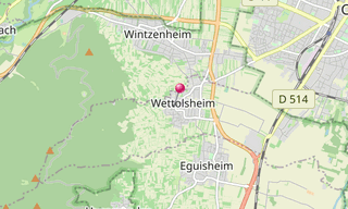
-Ch%C3%A2teau-de-Haut-Eguisheim.hero.jpg?w=320)
2. Wettolsheim
19 Photos
Page updated the Wednesday, 22 November 2023
Wettolsheim is a wine-growing town located in the administrative district of Haut-Rhin, 5 km south-west of Colmar, between Wintzenheim and Eguisheim, and …
-Brassia-Toscana.hero.jpg?w=320)
3. Flowers
7 Photos
Page added the Monday, 21 February 2022
Orchids, are diverse and widespread flowering plants, with blooms that are often colourful and fragrant.
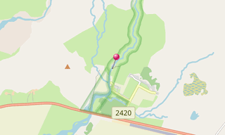
/Dolomites/Dolomiti-(1196)-Alpe-di-Siusi-Sassolungo.hero.jpg?w=320)
4. Dolomites
48 Photos
Page updated the Sunday, 17 October 2021
The Dolomites (Dolomiti), also known as the Dolomite Mountains, Dolomite Alps or Dolomitic Alps, are a mountain range located in northeastern Italy. They …
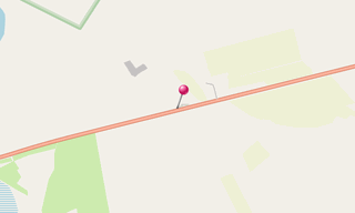
/Dolomites.map.png)
-Siegestor.hero.jpg?w=320)
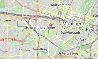
5. Munich by night
14 Photos
Page updated the Monday, 4 October 2021
Munich’s old town at night offers a very special atmosphere.
/Marta-(014).hero.jpg?w=320)
6. Marta (Lazio)
9 Photos
Page added the Sunday, 3 October 2021
Marta is a comune in the Province of Viterbo in the Italian region Latium, located about 80 km northwest of Rome and about 20km northwest of Viterbo. Marta …
.map.png)
-Santa-Maria-della-Consolazione.hero.jpg?w=320)
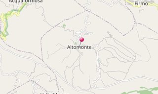
7. Altomonte
8 Photos
Page added the Tuesday, 17 August 2021
Altomonte is a municipality in the province of Cosenza, in the region of Calabria. The city was first called Braal, then Bragalla, Bragallum, Antifluvius …
.hero.jpg?w=320)
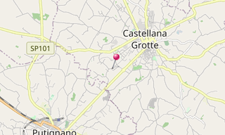
8. Castellana Caves
6 Photos
Page added the Tuesday, 17 August 2021
The Castellana Caves (Grotte di Castellana) are a karst cave system located in the municipality of Castellana Grotte, in the Metropolitan City of Bari, …
.hero.jpg?w=320)
9. Church village of Wamberg
12 Photos
Page added the Wednesday, 7 July 2021
The church village of Wamberg is part of the municipality of Garmisch-Partenkirchen (Upper Bavaria) at 996 m. The place is on the north side of the Wamberg saddle …
-Wallfahrtskirche.hero.jpg?w=320)
10. Pilgrimage church Wilparting
23 Photos
Page updated the Friday, 4 June 2021
The pilgrimage church of St. Marinus and Anian (Wallfahrtskirche Wilparting) is the Catholic village church of Wilparting, a district of the municipality …
-Schlehdorf-am-Kochelsee.hero.jpg?w=320)
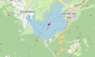
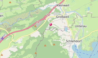
11. Kochelsee
15 Photos
Page updated the Friday, 4 June 2021
The Kochelsee (Lake Kochel) is located 70 km south of Munich on the edge of the Bavarian Alps. It belongs to the communities Schlehdorf in the west and …
-Zugspitze.hero.jpg?w=320)
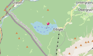
12. Eibsee
21 Photos
Page updated the Friday, 4 June 2021
The Eibsee is a lake 9 km southwest of Garmisch-Partenkirchen below (3.5 km north) of the Zugspitze (2,962 m) in the Wetterstein mountains in Bavaria. In …
-Inning-am-Ammersee.hero.jpg?w=320)
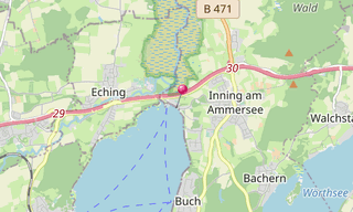
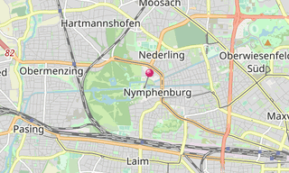
13. Ammersee
42 Photos
Page updated the Tuesday, 2 March 2021
The Ammersee is after Chiemsee and Lake Starnberg the third largest lake in Bavaria (under the lakes, which lie exclusively in Bavaria) and reaching the …
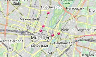
/Sommer-in-der-Stadt-(Munich)-(0232).hero.jpg?w=320)
14. Summer in the city (Munich)
20 Photos
Page added the Friday, 14 August 2020
Despite Corona and the cancellation of the Oktoberfest, the Bavarian capital has launched the “Summer in the city” campaign (Sommer in der Stadt). Rides …
.map.png)
-(043)-BW-Norway.hero.jpg?w=320)
15. Black & white landscapes
78 Photos
Page added the Saturday, 4 July 2020
Color is wonderful, but there’s something truly spectacular about black and white landscapes. Black and white is an expressive and timeless way of capturing …
-IR-Munich-Germany.hero.jpg?w=320)
16. Infrared landscapes
15 Photos
Page added the Saturday, 4 July 2020
Infrared photography makes a world visible that is normally hidden from the human eye. Infrared photography refers to the photographing of subjects in the …
.hero.jpg?w=320)
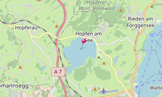
17. Hopfensee
2 Photos
Page added the Sunday, 16 February 2020
The Hopfensee is a maximum 2.1 km long lake with a circumference of 6.8 km north of Füssen in the district of Ostallgäu, Bavarian Swabia, Bavaria. With …
.hero.jpg?w=320)
18. Zugspitze
34 Photos
Page added the Saturday, 18 January 2020
The Zugspitze with 2,962 m is the highest peak of the Wetterstein Mountains and at the same time Germany’s highest mountain. The Zugspitze massif is located …
/Geroldsee-(322).hero.jpg?w=320)
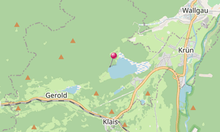
19. Geroldsee (Wagenbrüchsee)
27 Photos
Page updated the Monday, 14 October 2019
The Geroldsee, also called Wagenbrüchsee, is a bog lake near Krün, a few kilometers from Garmisch-Partenkirchen. It has an area of 10.6 hectares, a maximum …
.map.png)
.hero.jpg?w=320)
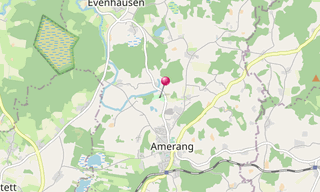
20. Farmhouse museum Amerang
50 Photos
Page added the Wednesday, 25 September 2019
The farmhouse museum Amerang is an open-air museum and is located in the Upper Bavarian foothills of the Amerang region in Chiemgau. It is affiliated to …
.hero.jpg?w=320)
21. Open-air museum Glentleiten
110 Photos
Page added the Monday, 2 September 2019
The open-air museum Glentleiten is the museum of the district Upper Bavaria for the rural life, living and economics of past centuries. It is located above …
/Plansee-(Tirol)-(026).hero.jpg?w=320)
22. Plansee (Tyrol)
7 Photos
Page added the Monday, 1 April 2019
The Plansee is located in the district of Reutte, Tyrol, Austria within the Ammergau Alps. With almost 3 km², it is the second largest natural lake in …
.map.png)
-(043).hero.jpg?w=320)
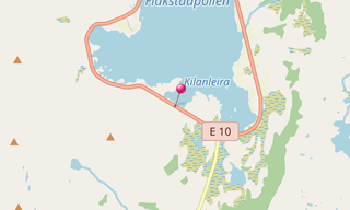
23. Flakstadpollen
6 Photos
Page added the Saturday, 2 March 2019
Flakstadpollen is a bay north of Flakstadøya, in the municipality of Flakstad, Nordland, which stretches for 3 km to the southwest from the inlet between …
-(041).hero.jpg?w=320)
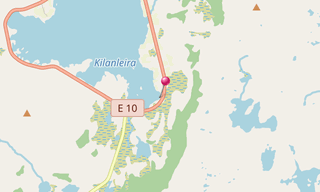
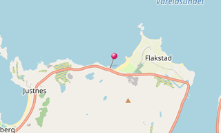
24. Kilan
6 Photos
Page added the Saturday, 2 March 2019
Kilan is a town in Nordland County, Norway. Administratively, Kilan is part of the municipality of Flakstad.
-(425).hero.jpg?w=320)
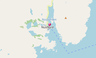
25. Nusfjord
15 Photos
Page added the Saturday, 2 March 2019
Nusfjord is a fishing village on Flakstadøy, one of the main islands of the Lofoten archipelago. The village belongs to Flakstad commune in Fylke, Norway …
-(505).hero.jpg?w=320)
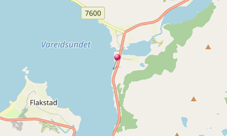
26. Vareid
12 Photos
Page added the Saturday, 2 March 2019
Vareid is a town in Nordland County, Norway. Administratively, Vareid is part of the municipality of Flakstad.
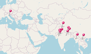
/Aurora-Borealis-(Lofoten)-(053).hero.jpg?w=320)
27. Aurora Borealis (Lofoten)
6 Photos
Page added the Saturday, 2 March 2019
Norway is an area normally associated with the appearance of Aurora Borealis. There, under the auroral oval, one can observe the Aurora Borealis very often, …
.map.png)
-(021).hero.jpg?w=320)
28. Skagsanden
5 Photos
Page added the Saturday, 2 March 2019
Skagsanden is a small and beautiful golden-sand beach in Nordland County, Norway. Administratively, Skagsanden is part of the municipality of Flakstad. …
-(034).hero.jpg?w=320)
29. Sakrisøy
6 Photos
Page added the Saturday, 2 March 2019
Sakrisøy (Sakrisøya) is a small island and a fishing village between Reine and Hamnøy in the municipality of Moskenes in Lofoten. The island is located …
/%C3%85-(Lofoten)-(004).hero.jpg?w=320)
30. Å (Lofoten)
2 Photos
Page added the Saturday, 2 March 2019
Å (Å i Lofoten), from å meaning “stream”, is a village in Moskenes municipality in Nordland county, Norway. It is located about 2 km southwest of the village …
.map.png)
-(208).hero.jpg?w=320)
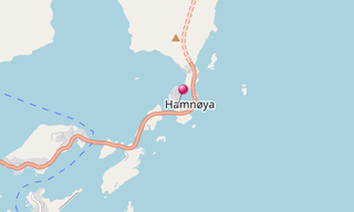
31. Hamnøy
3 Photos
Page added the Saturday, 2 March 2019
Hamnøy or Hamnøya is a small fishing village in Moskenes Municipality in Nordland county, Norway. It is located on the eastern side of the island of Moskenesøya …
-(666).hero.jpg?w=320)
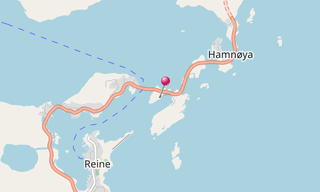
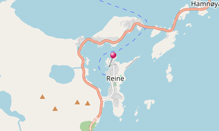
32. Reine
15 Photos
Page added the Saturday, 2 March 2019
Reine is the administrative centre of Moskenes Municipality in Nordland county, Norway. The fishing village is located on the island of Moskenesøya in the …
-(016).hero.jpg?w=320)
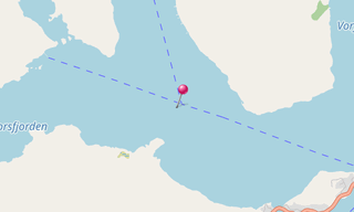
33. Reinefjorden
18 Photos
Page added the Saturday, 2 March 2019
The Reinefjorden (Reinefjord) is a fjord arm of the Vestfjord in the municipality of Moskenes in Nordland, which extends almost 3 km in an easterly direction …
-(100).hero.jpg?w=320)
34. Haukland
8 Photos
Page added the Saturday, 2 March 2019
Haukland is a town in Nordland County, Norway. Administratively, Haukland is part of the municipality of Vestvågøy.
-(016).hero.jpg?w=320)
35. Mærvollspollen Fjord
2 Photos
Page added the Saturday, 2 March 2019
Mærvollspollen is a fjord arm of the Steinsfjord on the island of Vestvågøy in the Lofoten. The fjord stretches about 2 km east of the hamlet Saupstad in …
-(334).hero.jpg?w=320)
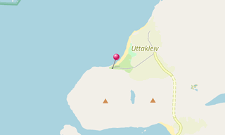
36. Utakleiv
20 Photos
Page added the Saturday, 2 March 2019
Utakleiv is a town in Nordland County, Norway. Administratively, Utakleiv is part of the municipality of Vestvågøy.
/Vik-Beach-(Lofoten)-(036).hero.jpg?w=320)
37. Vik (Lofoten)
7 Photos
Page added the Saturday, 2 March 2019
Vik is a town in Nordland County, Norway. Administratively, Vik is part of the municipality of Vestvågøy.
.map.png)
.hero.jpg?w=320)
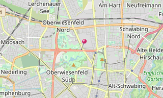
38. BMW Welt
8 Photos
Page added the Sunday, 18 November 2018
The BMW Welt (BMW World) is a combined exhibition, museum and delivery site, located near the Olympic Park in the immediate vicinity of the BMW Tour (BMW four-cylinder …
/Staatliches-Museum-%C3%84gyptischer-Kunst-(Munich)-(184)-Sarcophagus-Mask-of-Sitdjehuty.hero.jpg?w=320)
39. Staatliches Museum Ägyptischer Kunst (Munich)
108 Photos
Page updated the Sunday, 4 November 2018
The State Museum of Egyptian Art (Staatliche Museum Ägyptischer Kunst) in Munich is the most important in Germany after the collections in Berlin (Egyptian Museum …
.map.png)
.hero.jpg?w=320)
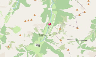
40. Großer Ahornboden
8 Photos
Page added the Tuesday, 16 October 2018
The Große Ahornboden lies at the head of the Rißtal valley, the Enger valley, just before the village of Eng between 1080 and 1300 m above sea level in …
.hero.jpg?w=320)
41. Barmsee
3 Photos
Page added the Tuesday, 16 October 2018
The Barmsee is a maximum of 1.12 km long and a maximum of 0.49 km wide lake in the district of Garmisch-Partenkirchen (Upper Bavaria) in the territory of …
-2013.hero.jpg?w=320)
42. Oktoberfest
194 Photos
Page updated the Sunday, 7 October 2018
The Oktoberfest is the world’s largest fair held annually in Munich. It is a 16-day festival running from late September to the first weekend in October …
-Basilika-St-Alexander-und-Theodor.hero.jpg?w=320)
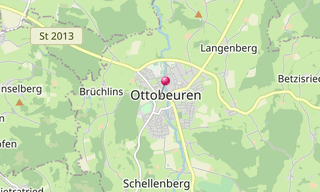
43. Ottobeuren Abbey
66 Photos
Page added the Sunday, 27 May 2018
The monastery Ottobeuren is a Benedictine abbey in the Upper Swabian Ottobeuren. The monastery consecrated to the two saints Alexander of Rome and Theodore Tiro …
/Hintersee-(Ramsauer-Ache)-(127).hero.jpg?w=320)
44. Hintersee (Ramsauer Ache)
10 Photos
Page added the Sunday, 8 April 2018
The Hintersee (formerly Ferchensee or Forchensee) is a 16.4 hectare lake in the municipality of Ramsau in the Berchtesgadener Land, about two kilometers …
.map.png)
.hero.jpg?w=320)
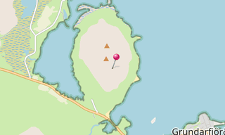
45. Kirkjufell
5 Photos
Page added the Tuesday, 6 March 2018
Mount Kirkjufell (463 m) is located in the west of Iceland, near the town of Grundarfjörður on the western shore of the fjord Grundarfjörður in the north …
.hero.jpg?w=320)
46. Hvítserkur
7 Photos
Page added the Tuesday, 6 March 2018
Hvítserkur is a 15 m high basalt stack along the eastern shore of the Vatnsnes peninsula, in northwest Iceland. The rock has two holes at the base, which …
.hero.jpg?w=320)
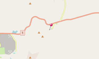
47. Goðafoss
8 Photos
Page added the Tuesday, 6 March 2018
The Goðafoss (“waterfall of the gods” or “waterfall of the goði”) is a waterfall in Iceland. It is located in the Bárðardalur district of Northeastern Region …
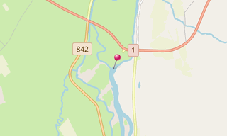
.hero.jpg?w=320)
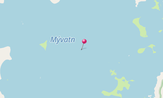
48. Mývatn
5 Photos
Page added the Tuesday, 6 March 2018
Mývatn is a shallow eutrophic lake situated in an area of active volcanism in the north of Iceland, not far from Krafla volcano. The lake and its surrounding …
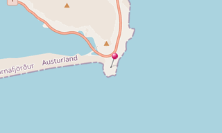
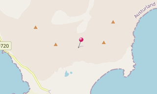
/East-Fjords-(004).hero.jpg?w=320)
49. East Fjords (Iceland)
6 Photos
Page added the Tuesday, 6 March 2018
Eastern Region (Austurland, also known as Austfirðir: “East Fjords”) is a region in eastern Iceland. Its area is 22,721 km² and in 2007 its population was …
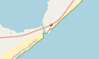
.map.png)
.hero.jpg?w=320)
50. Eystrahorn
4 Photos
Page added the Tuesday, 6 March 2018
Part of the Krossanesfjall is the famous rock outcrop Eystrahorn (also called Austurhorn), on the other side of the wide bay of Lón the Vestrahorn (757 m). …
.hero.jpg?w=320)
51. Hverarönd
28 Photos
Page added the Tuesday, 6 March 2018
Hverarönd, literally meaning “hot springs of the ducks”, also called by Námafjall metonymy of the name of the mountain at the foot of which it is located, …
.hero.jpg?w=320)
52. Icelandic Landscapes
3 Photos
Page added the Tuesday, 6 March 2018
Iceland has extensive volcanic and geothermal activity. The rift associated with the Mid-Atlantic Ridge, which marks the division between the Eurasian Plate …
.hero.jpg?w=320)
53. Klifatindur
16 Photos
Page added the Tuesday, 6 March 2018
The mountain Klifatindur is located in southern Iceland and is 889 m high. An important part of this mountain range is the Vestrahorn (757 m). In front …
-Vatnaj%C3%B6kull.hero.jpg?w=320)
54. Vatnajökull ice caves
9 Photos
Page added the Tuesday, 6 March 2018
Glacier caves are caves formed within the ice of a glacier and are often called ice caves. The glacier caves are started by water running through or under …
/Aurora-Borealis-(Iceland)-(054)-J%C3%B6kuls%C3%A1rl%C3%B3n.hero.jpg?w=320)
55. Aurora Borealis (Iceland)
11 Photos
Page added the Tuesday, 6 March 2018
An aurora borealis, sometimes referred to as polar lights, northern lights, is a natural light display in the Earth’s sky, predominantly seen in the high-latitude …
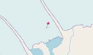
.map.png)
.hero.jpg?w=320)
56. Breiðamerkursandur
17 Photos
Page added the Tuesday, 6 March 2018
Breiðamerkursandur (also called Diamond Beach for the pieces of glacial ice washed up on the beach) is a sandur (a glacial outwash plain) in southeast …
.hero.jpg?w=320)
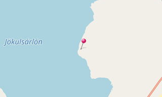
57. Jökulsárlón
26 Photos
Page added the Tuesday, 6 March 2018
Jökulsárlón, literally “glacial river lagoon”, is a large glacial lake in southeast Iceland, on the edge of Vatnajökull National Park. Situated at the head …
.hero.jpg?w=320)
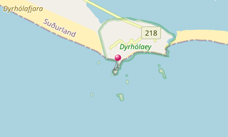
58. Dyrhólaey
7 Photos
Page added the Tuesday, 6 March 2018
The small peninsula, or promontory, Dyrhólaey (120 m) (formerly known as “Cape Portland” by seamen) is located on the south coast of Iceland, not far from …
.hero.jpg?w=320)
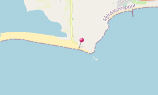
59. Reynisfjara
20 Photos
Page added the Tuesday, 6 March 2018
Reynisdrangar are basalt sea stacks situated under the mountain Reynisfjall near the village Vík í Mýrdal, southern Iceland which is framed by a black sand …
.hero.jpg?w=320)
60. Skógafoss
5 Photos
Page added the Tuesday, 6 March 2018
Skógafoss is a waterfall situated on the Skógá River in the south of Iceland at the cliffs of the former coastline. After the coastline had receded seaward …